Geographic Region: BOLIVIA
Feature: LAGO POOPO
|
Geographic Region: BOLIVIA Feature: LAGO POOPO |
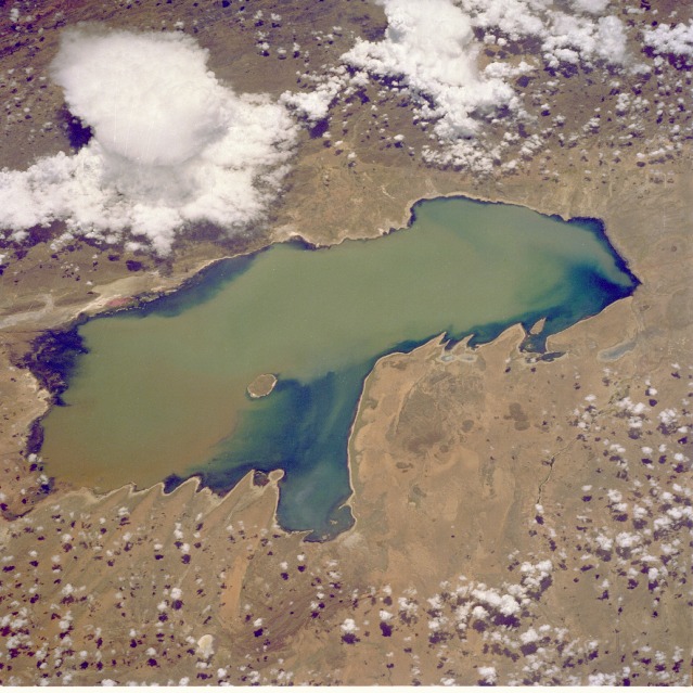 |
| STS032-088-069 Lake Poopó, Bolivia January 1990 Shallow Lake Poopó, a brackish lake in the Altiplano of southwestern Bolivia, has as its major water supply the Desaguadero River, which flows intermittently southeastward from Lake Titicaca. Visible in this closeup photograph of Lake Poopó are a sediment plume that has entered the lake from the northwest and its dispersal pattern and a single-cell thunderstorm near the northeastern shoreline. This photograph is one in a series spanning two decades that documents water level fluctuations of the lake. (Refer to STS-048-072-049, STS-064-091-022, STS-51J-144-0023, and STS-073-735-047 for additional photographs and data.) |
| Images: | All Available Images Low-Resolution 135k |
|
| Mission: | STS032 |
|
| Roll - Frame: | 88 - 69 |
|
| Geographical Name: | BOLIVIA |
|
| Features: | LAGO POOPO |
|
| Center Lat x Lon: | 19S x 67W |
|
| Film Exposure: | N | N=Normal exposure, U=Under exposed, O=Over exposed, F=out of Focus |
| Percentage of Cloud Cover-CLDP: | 50 |
|
| Camera:: | HB |
|
| Camera Tilt: | LO | LO=Low Oblique, HO=High Oblique, NV=Near Vertical |
| Camera Focal Length: | 250 |
|
| Nadir to Photo Center Direction: | E | The direction from the nadir to the center point, N=North, S=South, E=East, W=West |
| Stereo?: | N | Y=Yes there is an adjacent picture of the same area, N=No there isn't |
| Orbit Number: | 161 |
|
| Date: | 19900119 | YYYYMMDD |
| Time: | 154811 | GMT HHMMSS |
| Nadir Lat: | 17.9S |
Latitude of suborbital point of spacecraft |
| Nadir Lon: | 72.6W |
Longitude of suborbital point of spacecraft |
| Sun Azimuth: | 100 | Clockwise angle in degrees from north to the sun measured at the nadir point |
| Space Craft Altitude: | 177 | nautical miles |
| Sun Elevation: | 72 | Angle in degrees between the horizon and the sun, measured at the nadir point |
| Land Views: | BASIN, PLATEAU |
|
| Water Views: | LAKE, SEDIMENT |
|
| Atmosphere Views: | THUNDERSTORM |
|
| Man Made Views: | |
|
| City Views: | |
|
Associated Photos in Sequence:  Photo #: STS057-99-65 Photo #: STS057-99-65Description: PERU/BOLIVIA-1993; L. TITICACA, L. POOPO REGION-SYNOPTIC VIEW Sequence ID: 6A  Photo #: SL3-115-1911 Photo #: SL3-115-1911Description: BOLIVIA, LAKE POOPO-1973; LAKE LEVEL Sequence ID: 6B  Photo #: STS51J-144-23 Photo #: STS51J-144-23Description: BOLIVIA, LAKE POOPO-1985; LAKE LEVEL Sequence ID: 6C 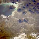 Photo #: STS026-40-64 Photo #: STS026-40-64Description: BOLIVIA, LAKE POOPO, LAKE COIPASA-1988; LAKE POOPO LAKE LEVEL Sequence ID: 6D  Photo #: STS032-88-69 ** Currently displayed photo ** Photo #: STS032-88-69 ** Currently displayed photo ** Description: BOLIVIA, LAKE POOPO-1990; LAKE LEVEL Sequence ID: 6E  Photo #: STS048-72-49 Photo #: STS048-72-49Description: BOLIVIA, LAKE POOPO-1991; LAKE LEVEL CHANGES Sequence ID: 6F  Photo #: STS064-91-22 Photo #: STS064-91-22Description: BOLIVIA, LAKE POOPO-1994; DECREASING LAKE LEVEL Sequence ID: 6G 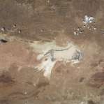 Photo #: STS073-735-47 Photo #: STS073-735-47Description: BOLIVIA, LAKE POOPO-1995; LAKE IS DRY Sequence ID: 6H | ||
| NASA Home Page |
JSC Home Page |
JSC Digital Image Collection |
Earth Science & Remote Sensing |
|
This service is provided by the International Space Station program and the JSC Earth Science & Remote Sensing Unit, ARES Division, Exploration Integration Science Directorate.

|