
Geographic Region: USA-IOWA
Feature: SIOUX CITY, MISSOURI R.
|
Geographic Region: USA-IOWA Feature: SIOUX CITY, MISSOURI R. |
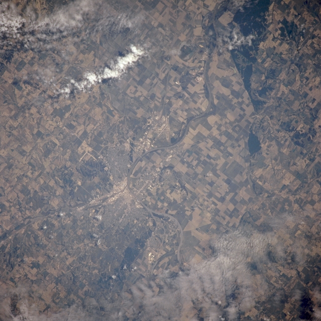 |
| NM21-763-036 Sioux City, Iowa, U.S.A. Winter 1995-1996 Featured in this northeast-looking, low-oblique photograph is the Missouri River. Visible to the west in Nebraska are the flat plains of the Missouri River Valley with their predominant agricultural field patterns. Sioux City, situated at the confluence of the Big Sioux, Floyd, and Missouri Rivers, is a shipping, trade, and industrial center for an extensive agricultural and livestock area. Bluffs rising 100 to 200 feet (31 to 62 meters) border Sioux City on the east and northeast. The runways of Sioux City Municipal Airport are visible south of the city. |
| Images: | All Available Images Low-Resolution 338k |
|
| Mission: | NM21 |
|
| Roll - Frame: | 763 - 36 |
|
| Geographical Name: | USA-IOWA |
|
| Features: | SIOUX CITY, MISSOURI R. |
|
| Center Lat x Lon: | 42.5N x 96.5W |
|
| Film Exposure: | N | N=Normal exposure, U=Under exposed, O=Over exposed, F=out of Focus |
| Percentage of Cloud Cover-CLDP: | 20 |
|
| Camera:: | HB |
|
| Camera Tilt: | 16 | LO=Low Oblique, HO=High Oblique, NV=Near Vertical |
| Camera Focal Length: | 250 |
|
| Nadir to Photo Center Direction: | W | The direction from the nadir to the center point, N=North, S=South, E=East, W=West |
| Stereo?: | N | Y=Yes there is an adjacent picture of the same area, N=No there isn't |
| Orbit Number: | 999 |
|
| Date: | 19960629 | YYYYMMDD |
| Time: | 185943 | GMT HHMMSS |
| Nadir Lat: | 42.4N |
Latitude of suborbital point of spacecraft |
| Nadir Lon: | 95.5W |
Longitude of suborbital point of spacecraft |
| Sun Azimuth: | 203 | Clockwise angle in degrees from north to the sun measured at the nadir point |
| Space Craft Altitude: | 208 | nautical miles |
| Sun Elevation: | 70 | Angle in degrees between the horizon and the sun, measured at the nadir point |
| Land Views: | VALLEY |
|
| Water Views: | RIVER |
|
| Atmosphere Views: | |
|
| Man Made Views: | URBAN AREA, AGRICULTURE, AIRPORT |
|
| City Views: | SIOUX CITY |
|
Photo is not associated with any sequences | ||
| NASA Home Page |
JSC Home Page |
JSC Digital Image Collection |
Earth Science & Remote Sensing |
|
This service is provided by the International Space Station program and the JSC Earth Science & Remote Sensing Unit, ARES Division, Exploration Integration Science Directorate.

|