Return to Earth From Space Home
Earth from Space logo Image Information Earth from Space logo

Display a Screen Layout for Printing

IMAGE: gray corner       IMAGE: gray corner
  Image: Geographic Location Direction Photo #: STS51G-34-60 Date: Jun. 1985
Geographic Region: BRAZIL
Feature: DEFORESTATION, RIO JAMARI

Ordering information for space photography
 
IMAGE: gray corner     IMAGE: gray corner

Image: gray corner     Image: gray corner
  View Low-Resolution Image  
  STS51G-034-0060 Rondonia, Brazil June 1985
Worldwide destruction of tropical rain forests has been under way for several decades. Nowhere has this destruction surpassed the deforestation of parts of the southern Amazon River Basin. The Brazilian state of Rondonia, which borders Bolivia, has been especially hard hit. This photograph shows the unique Brazilian pattern of clearing land only along transportation routes. Land clearings in the southern Amazon Basin usually radiate out in a perpendicular pattern from streams or roads. The clearings usually have a "herringbone" appearance. While the spacing of the perpendicular roads or tracts can vary, most of the intervals between these roads are 2 to 3 miles (4 to 5 kilometers). Photographs of the same geographic area collected on different dates provide information on changes that have occurred; for example, road clearings, slash and burn activities, and field pattern sizes. (Compare the clear-cut areas in this photograph with 1992 photograph STS-046-078-0026 taken 7 years later showing the clear-cut areas beginning to coalesce. Two small urban areas are on each photograph, but only one of the urban areas is common to both.)
 
Image: gray corner     Image: gray corner

Images: All Available Images Low-Resolution 136k
Mission: STS51G  
Roll - Frame: 34 - 60
Geographical Name: BRAZIL  
Features: DEFORESTATION, RIO JAMARI  
Center Lat x Lon: 10.5S x 62.5W
Film Exposure: U   N=Normal exposure, U=Under exposed, O=Over exposed, F=out of Focus
Percentage of Cloud Cover-CLDP: 10
 
Camera: HB
 
Camera Tilt: 11   LO=Low Oblique, HO=High Oblique, NV=Near Vertical
Camera Focal Length: 250  
 
Nadir to Photo Center Direction: S   The direction from the nadir to the center point, N=North, S=South, E=East, W=West
Stereo?: Y   Y=Yes there is an adjacent picture of the same area, N=No there isn't
Orbit Number: 20  
 
Date: 19850618   YYYYMMDD
Time: 170553   GMT HHMMSS
Nadir Lat: 9.9S  
Latitude of suborbital point of spacecraft
Nadir Lon: 62.5W  
Longitude of suborbital point of spacecraft
Sun Azimuth: 338   Clockwise angle in degrees from north to the sun measured at the nadir point
Space Craft Altitude: 193   nautical miles
Sun Elevation: 54   Angle in degrees between the horizon and the sun, measured at the nadir point
Land Views: FOREST, BASIN  
Water Views: RIVER  
Atmosphere Views:  
Man Made Views: DEFORESTATION  
City Views:  
Associated Photos in Sequence:

IMAGEPhoto #: STS51G-34-60 ** Currently displayed photo **
Description: BRAZIL, AMAZON BASIN-1985; DEFORESTATION PATTERNS
Sequence ID: 7A

IMAGEPhoto #: STS046-78-26
Description: BRAZIL, AMAZON BASIN-1992; CHANGING DEFORESTATION PATTERNS
Sequence ID: 7B

IMAGE
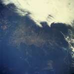
Photo #: STS046-80-36
Description: BRAZIL, AMAZON BASIN-1992; CHANGING DEFORESTATION PATTERNS
Sequence ID: 7C


NASA
Home Page
JSC
Home Page
JSC Digital
Image Collection
Earth Science &
Remote Sensing

NASA meatball logo
This service is provided by the International Space Station program and the JSC Earth Science & Remote Sensing Unit, ARES Division, Exploration Integration Science Directorate.
ESRS logo