ISS048-E-73267
| NASA Photo ID | ISS048-E-73267 |
| Focal Length | 800mm |
| Date taken | 2016.09.06 |
| Time taken | 17:27:38 GMT |
1000 x 666 pixels 540 x 360 pixels 4928 x 3280 pixels 720 x 480 pixels 4928 x 3280 pixels 640 x 426 pixels
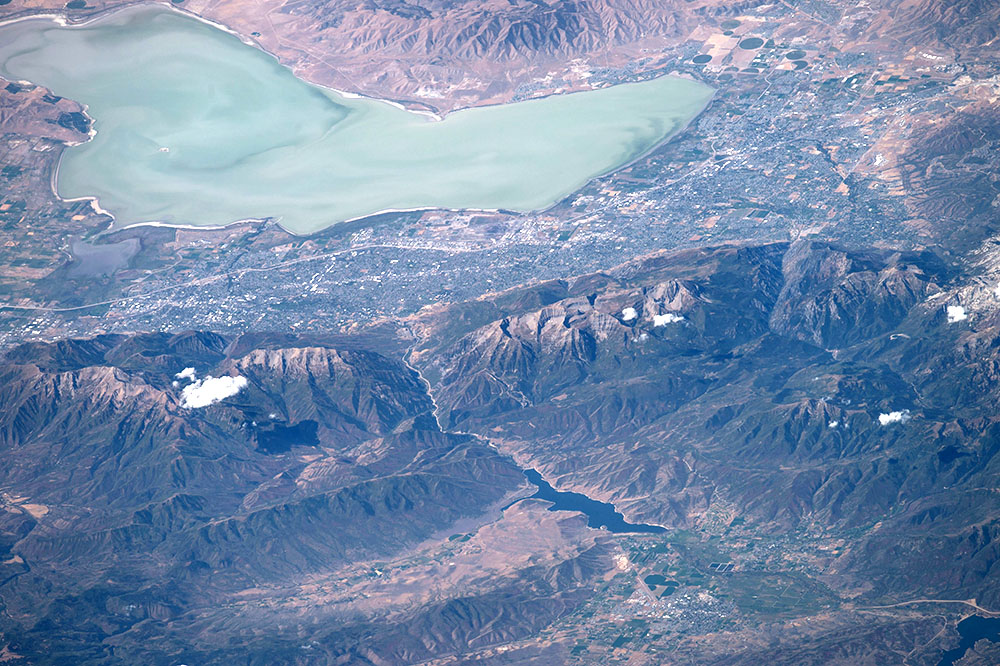
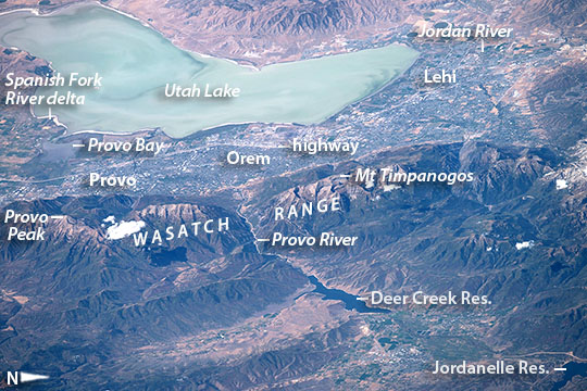
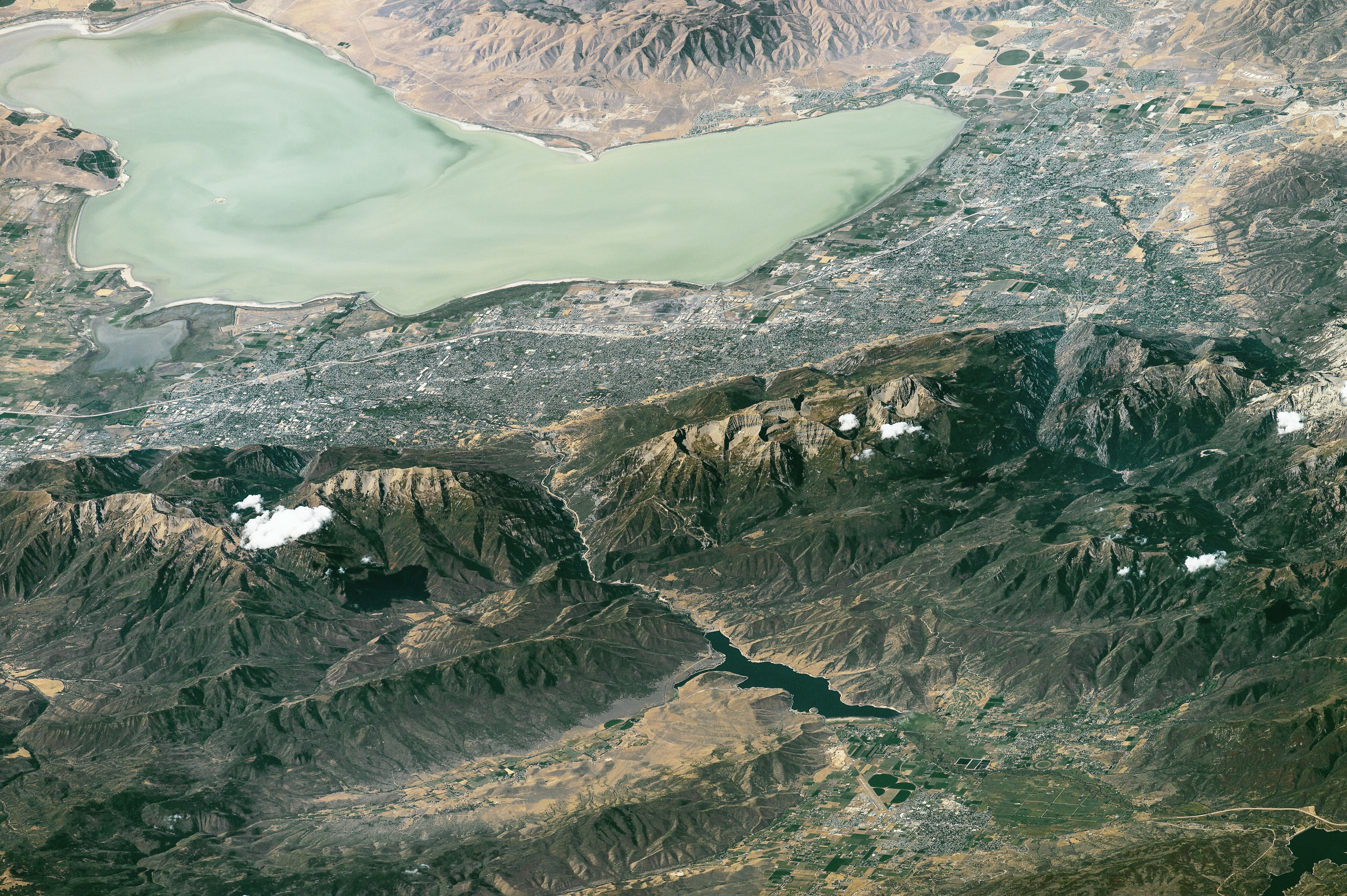
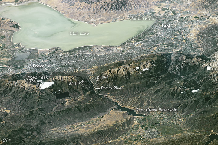
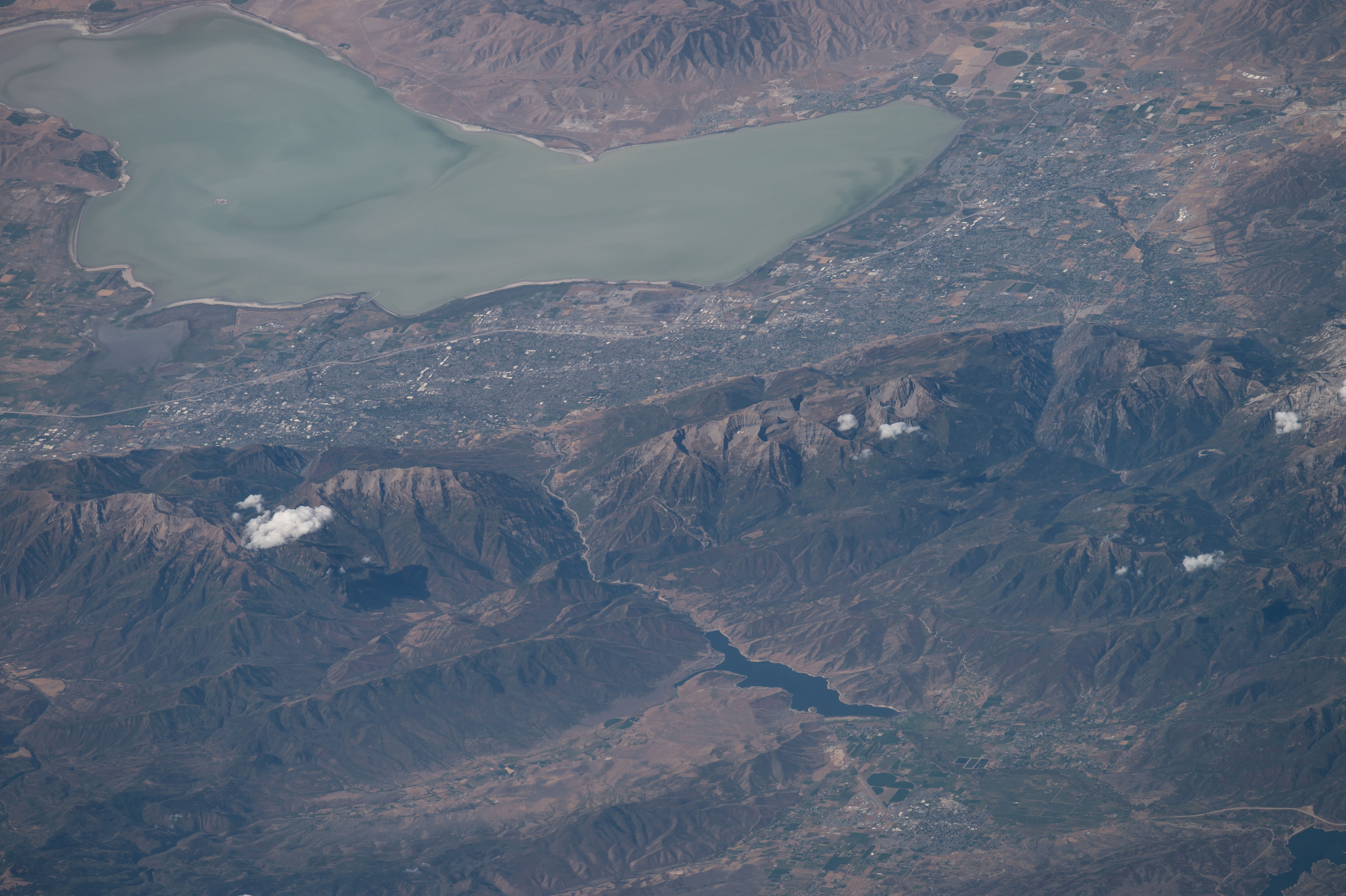

Photo center point: 40.4° N, 111.6° W
Photo center point by machine learning:
Country or Geographic Name: | USA-UTAH |
Features: | L. UTAH, WASATCH RA., PROVO |
| Features Found Using Machine Learning: | |
Cloud Cover Percentage: | 10 (1-10)% |
Sun Elevation Angle: | 49° |
Sun Azimuth: | 147° |
Camera: | Nikon D4 Electronic Still Camera |
Focal Length: | 800mm |
Camera Tilt: | High Oblique |
Format: | 4928E: 4928 x 3280 pixel CMOS sensor, 36.0mm x 23.9mm, total pixels: 16.6 million, Nikon FX format |
Film Exposure: | |
| Additional Information | |
| Width | Height | Annotated | Cropped | Purpose | Links |
|---|---|---|---|---|---|
| 1000 pixels | 666 pixels | No | No | Earth From Space collection | Download Image |
| 540 pixels | 360 pixels | Yes | No | Earth From Space collection | Download Image |
| 4928 pixels | 3280 pixels | No | No | NASA's Earth Observatory web site | Download Image |
| 720 pixels | 480 pixels | Yes | No | NASA's Earth Observatory web site | Download Image |
| 4928 pixels | 3280 pixels | No | No | Download Image | |
| 640 pixels | 426 pixels | No | No | Download Image |
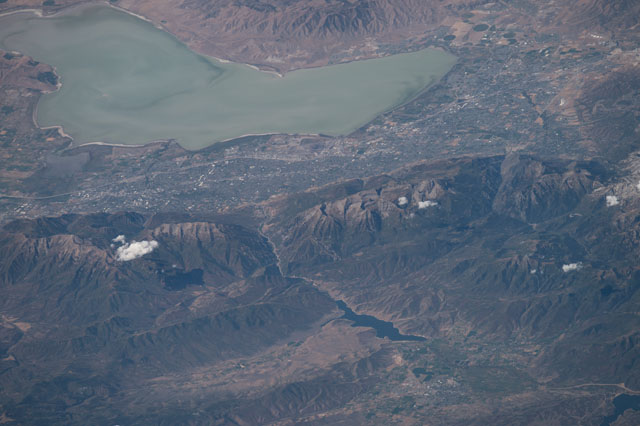
From a point near the Black Hills an astronaut aboard the International Space Station looked more than 700 km (400 miles) west and focused on the shorelines of lakes in Utah. Shorelines are easy to see from space and often indicate interesting centers of human activity. Being so far away the astronaut used a powerful 800 mm lens for this panoramic shot of Lake Utah, just south of Great Salt Lake. Utah Lake's only river outlet is the Jordan River (at image top right), which leads water to the Great Salt Lake at times when the lake is high. The lower part of the image shows the thickly wooded Wasatch Range that rises so high above the city that it captures rain. Provo Peak and Mt Timpanogos are two well-known local peaks.
Utah Lake is so shallow that surface waves stir up light-toned muds from the lake bottom, giving the lake a light green-blue hue (at image top). Across the middle of the image gray tones show the Provo-Orem metropolitan area that fringes the length of the lake. The lake is 33 km (20 miles) long, giving a sense of the extent of the metro area. The Veterans Memorial Highway is a straight white line running through the entire metro area in the view, from Provo to Lehi. All the green tones are farms that fringe the cities, right down to the water's edge.
Finding water for a population of more than half a million (526,800), and for local farming has always been problematic in arid Utah. Luckily snow and rainfall on the wetter Wasatch Range nearby provide enough water for these populations--with careful reuse of water. The main water supply points are the lake itself and rivers like the Provo and Spanish Fork that help fill the lake. These long rivers cut through the main Wasatch Range in dramatic canyons. The Provo River canyon appears at image center, and the delta of the Spanish Fork River juts into the lake (at image far left) south of Provo Bay. Dark shapes on the Provo River are the Deer Creek and Jordanelle reservoirs at image lower right.
