ISS048-E-72377

| NASA Photo ID | ISS048-E-72377 |
| Focal Length | 800mm |
| Date taken | 2016.09.04 |
| Time taken | 07:10:16 GMT |
2464 x 1640 pixels 720 x 480 pixels 4928 x 3280 pixels 640 x 426 pixels

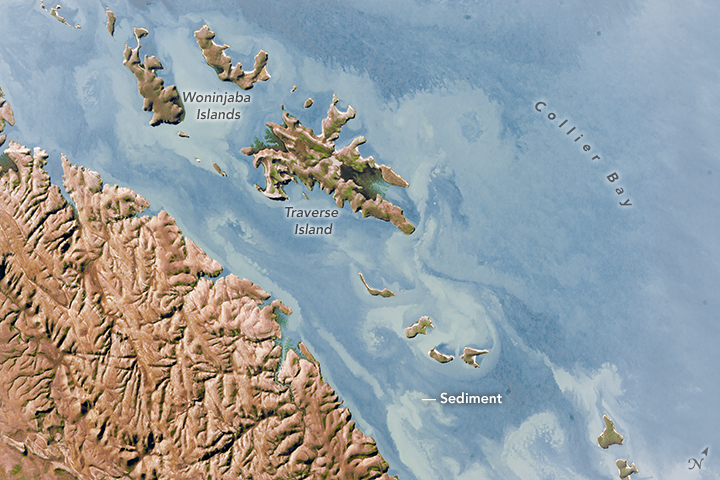
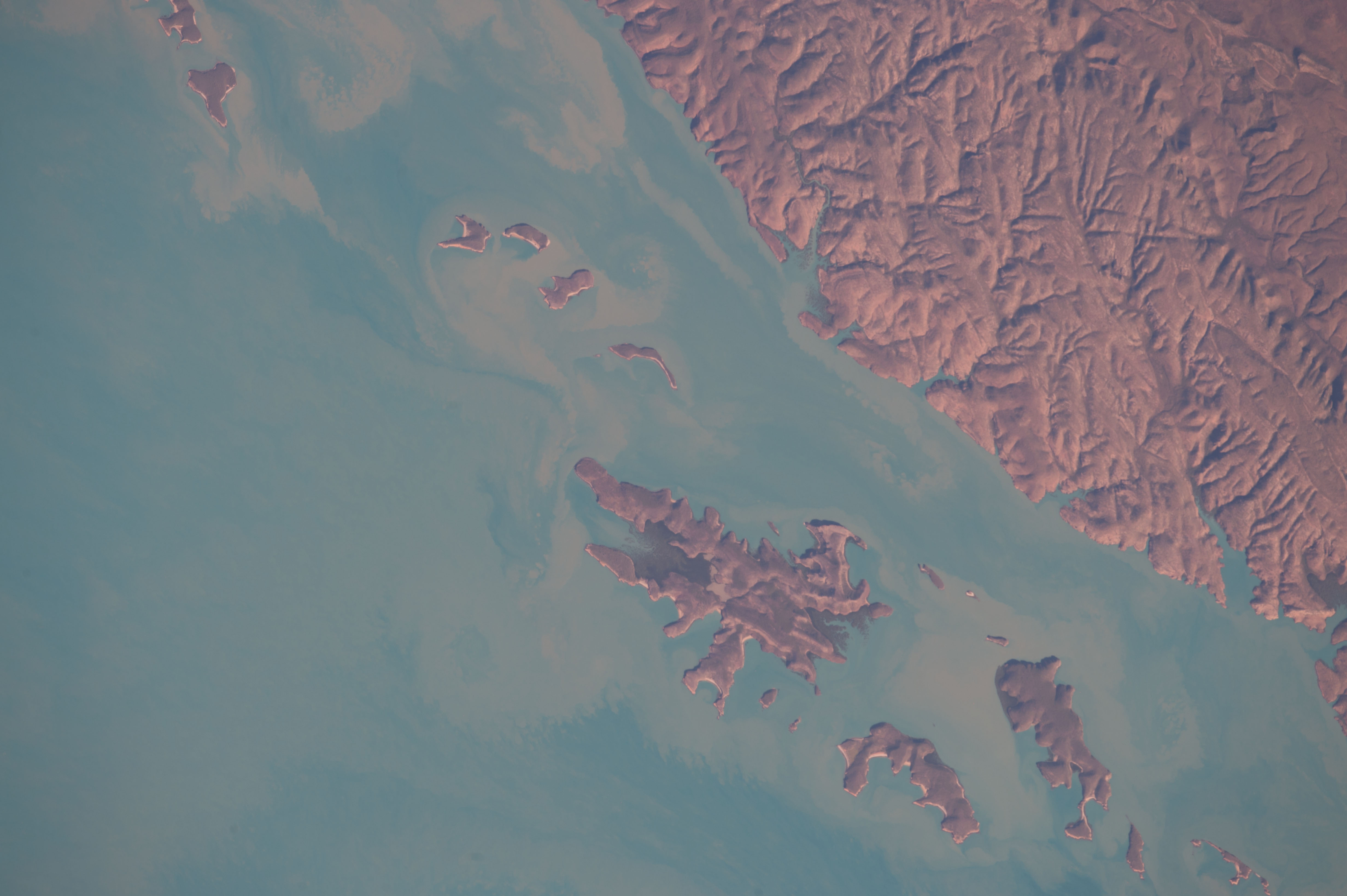


Photo center point: 16.3° S, 124.1° E
Photo center point by machine learning:
Country or Geographic Name: | AUSTRALIA-WA |
Features: | TRAVERSE ISLAND, COASTLINE, SEDIMENT |
| Features Found Using Machine Learning: | |
Cloud Cover Percentage: | 10 (1-10)% |
Sun Elevation Angle: | 33° |
Sun Azimuth: | 290° |
Camera: | Nikon D4 Electronic Still Camera |
Focal Length: | 800mm |
Camera Tilt: | 12 degrees |
Format: | 4928E: 4928 x 3280 pixel CMOS sensor, 36.0mm x 23.9mm, total pixels: 16.6 million, Nikon FX format |
Film Exposure: | |
| Additional Information | |
| Width | Height | Annotated | Cropped | Purpose | Links |
|---|---|---|---|---|---|
| 2464 pixels | 1640 pixels | No | No | NASA's Earth Observatory web site | Download Image |
| 720 pixels | 480 pixels | Yes | No | NASA's Earth Observatory web site | Download Image |
| 4928 pixels | 3280 pixels | No | No | Download Image | |
| 640 pixels | 426 pixels | No | No | Download Image |
Once clouds have cleared away, the effects of major storms often can be viewed from space for days and weeks. That is what happened when an astronaut aboard the International Space Station took this photograph of roughly 20 kilometers (12 miles) of coastline and islands on the northwest coast of Australia.
The tan and white swirls in the sea are sediments that washed out after an unusual rainfall event during the dry season. Rain fell inland on August 30-31, about five days before this image was taken, and the sediment was channeled down local rivers and out into Collier Bay. Rainfall records from two towns in the Kimberly region of Australia - 24 millimeters in Derby and 46 millimeters in Fitzroy Crossing - indicate that there was a continuous stretch of rainless days for weeks before and after this chance rainfall event. (The wet monsoon season runs from November to April.)
The sediment patches seem to be chaotic, but the ragged, finger-like pattern is actually typical where near-shore tides move water to and fro, especially at the heads of bays. Long, narrow patches of sediment also show the direction of the local ocean current, which runs from east to west (lower right to upper left, at image lower center).
The dominant sediment pattern in the image is the accumulation on the downstream side (north and west sides) of the islands, where the water is protected from the east-west ocean current. The biggest islands, Traverse and Woninjaba, have the biggest sediment patches.
The Kimberly region of Western Australia is so remote that boat and helicopter are the usual means of moving through this wilderness area. Tourists are drawn to the natural beauty of the mountainous scenery.
