ISS048-E-70125
| NASA Photo ID | ISS048-E-70125 |
| Focal Length | 36mm |
| Date taken | 2016.08.28 |
| Time taken | 09:40:33 GMT |
1000 x 666 pixels 540 x 360 pixels 4928 x 3280 pixels 720 x 480 pixels 4928 x 3280 pixels 640 x 426 pixels

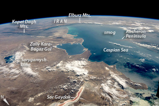
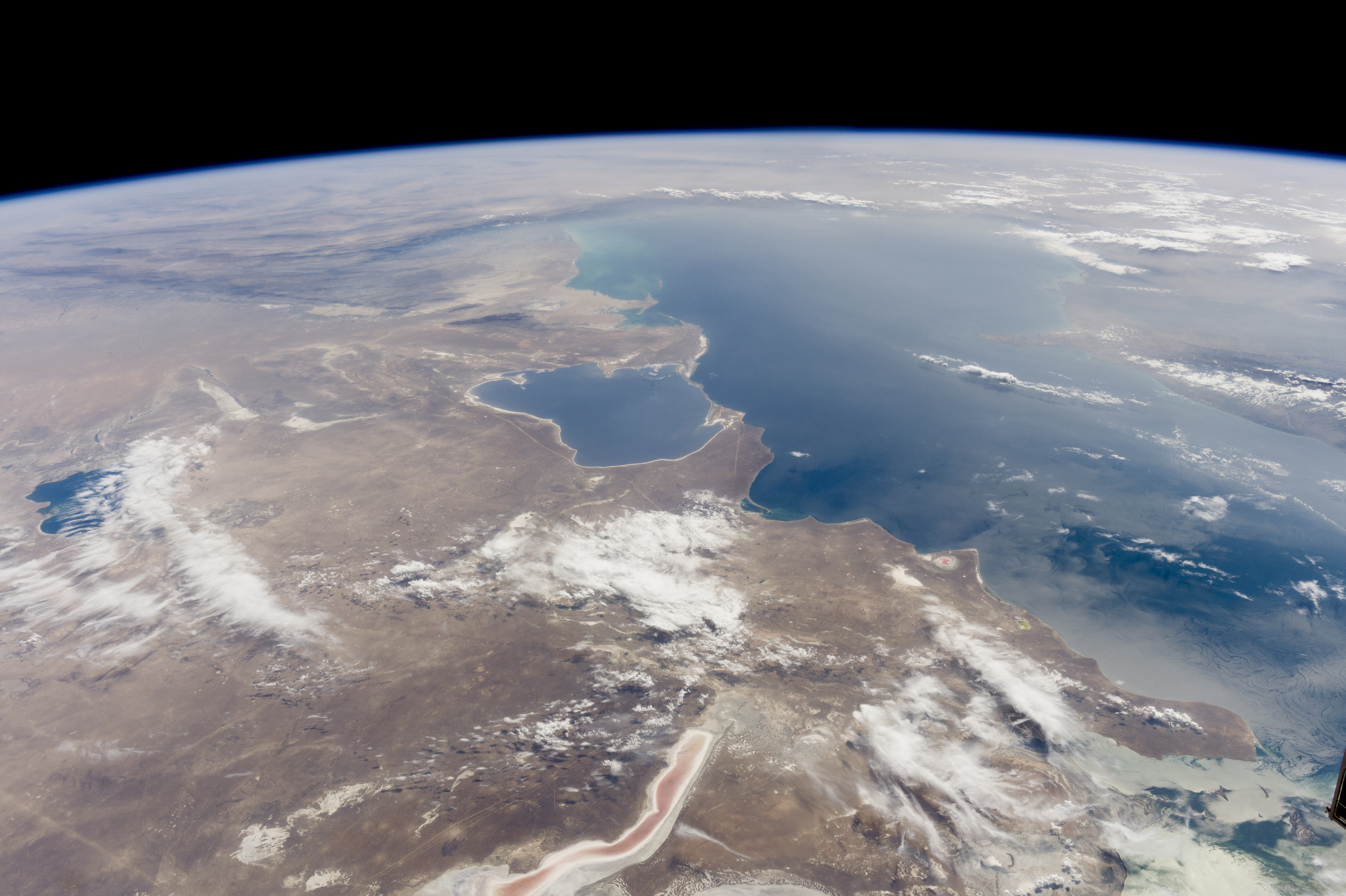
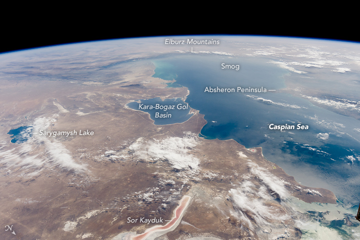

Photo center point: 42.0° N, 53.5° E
Photo center point by machine learning:
Country or Geographic Name: | TURKMENISTAN |
Features: | PAN_CASPIAN, KARABOGAZ G., ELBURZ MTS. |
| Features Found Using Machine Learning: | PAN- |
Cloud Cover Percentage: | 10 (1-10)% |
Sun Elevation Angle: | 48° |
Sun Azimuth: | 208° |
Camera: | Nikon D4 Electronic Still Camera |
Focal Length: | 36mm |
Camera Tilt: | High Oblique |
Format: | 4928E: 4928 x 3280 pixel CMOS sensor, 36.0mm x 23.9mm, total pixels: 16.6 million, Nikon FX format |
Film Exposure: | |
| Additional Information | |
| Width | Height | Annotated | Cropped | Purpose | Links |
|---|---|---|---|---|---|
| 1000 pixels | 666 pixels | No | No | Earth From Space collection | Download Image |
| 540 pixels | 360 pixels | Yes | No | Earth From Space collection | Download Image |
| 4928 pixels | 3280 pixels | No | No | NASA's Earth Observatory web site | Download Image |
| 720 pixels | 480 pixels | Yes | No | NASA's Earth Observatory web site | Download Image |
| 4928 pixels | 3280 pixels | No | No | Download Image | |
| 640 pixels | 426 pixels | No | No | Download Image |
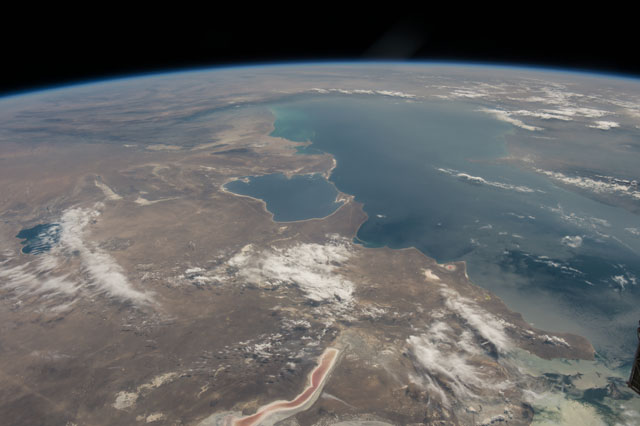
Looking south to the horizon, an astronaut aboard the International Space Station (ISS) took this photograph of most of the Caspian Sea and neighboring countries in inner Asia. Shorelines of water bodies are key features for astronauts trying to orient themselves over Earth.
The south shore of the sea appears as a nearly straight line against the dark ranges of the Elburz Mountains of northern Iran. At a right-angled corner - a telltale feature of the Caspian Sea for astronauts looking down at Earth - the coastline veers due north, where it meets the 160 kilometer-wide (100 mile) bay in Turkmenistan known as Zaliv Kara-Bogaz Gol. The narrow spit that divides this gulf from the Caspian Sea is another well-known feature. Saltwater Lake Sarygamish lies on the Turkmenistan-Uzbekistan border, and the narrow Sor Gaydak channel in Kazakhstan shows its characteristic pink tone.
The west side (right in this south-facing image) of the Caspian Sea lies under a thin smog layer, which partly obscures the finger of the Absheron Peninsula, the center of Azerbaijan's oil producing region. (Those facilities have previously been photographed in detail.)
