ISS047-E-84351

| NASA Photo ID | ISS047-E-84351 |
| Focal Length | 1150mm |
| Date taken | 2016.04.27 |
| Time taken | 13:19:57 GMT |
1000 x 666 pixels 540 x 360 pixels 4928 x 3280 pixels 720 x 480 pixels 4928 x 3280 pixels 640 x 426 pixels
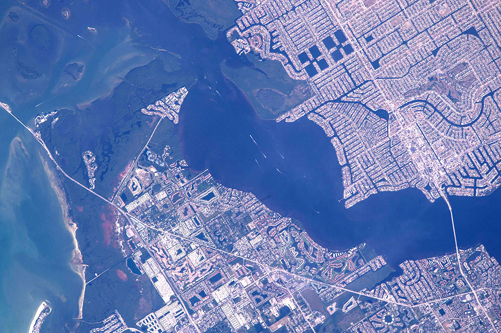

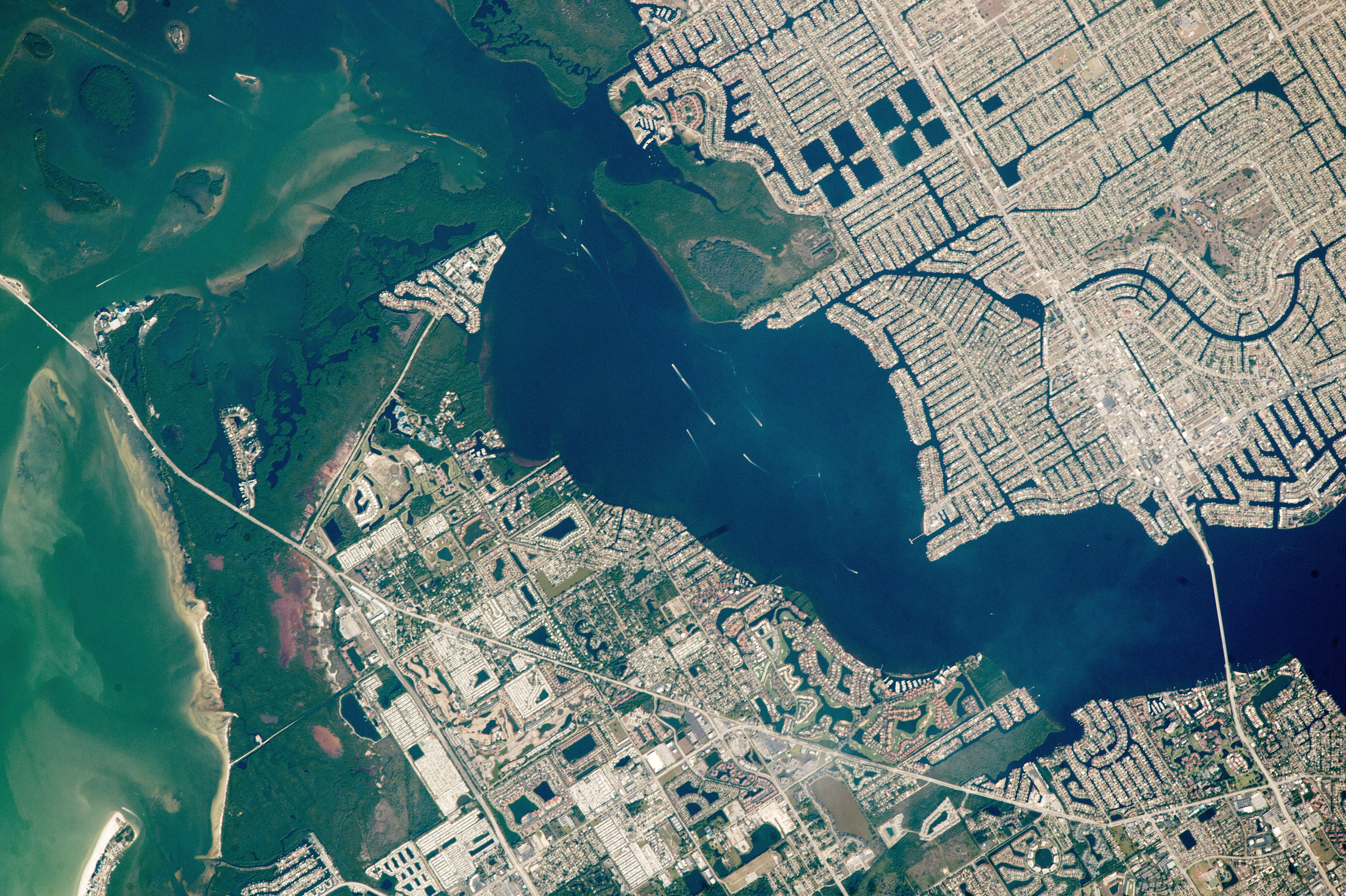
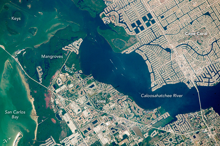
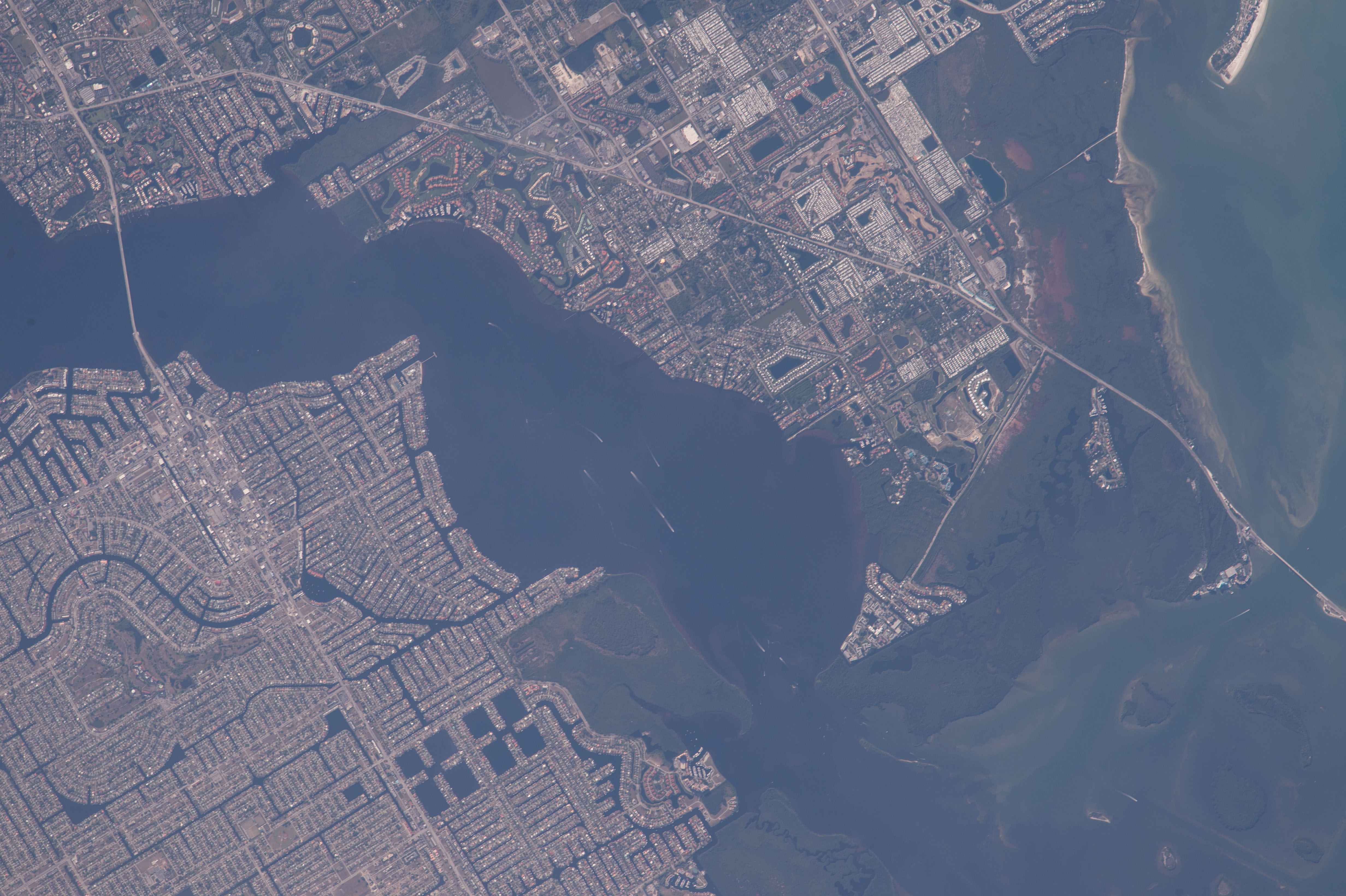


Photo center point: 26.5° N, 82.0° W
Photo center point by machine learning:
Country or Geographic Name: | USA-FLORIDA |
Features: | CAPE CORAL, IONA, CALOOSAHATCHEE R. |
| Features Found Using Machine Learning: | |
Cloud Cover Percentage: | 10 (1-10)% |
Sun Elevation Angle: | 32° |
Sun Azimuth: | 89° |
Camera: | Nikon D4 Electronic Still Camera |
Focal Length: | 1150mm |
Camera Tilt: | 04 degrees |
Format: | 4928E: 4928 x 3280 pixel CMOS sensor, 36.0mm x 23.9mm, total pixels: 16.6 million, Nikon FX format |
Film Exposure: | |
| Additional Information | |
| Width | Height | Annotated | Cropped | Purpose | Links |
|---|---|---|---|---|---|
| 1000 pixels | 666 pixels | No | No | Earth From Space collection | Download Image |
| 540 pixels | 360 pixels | Yes | No | Earth From Space collection | Download Image |
| 4928 pixels | 3280 pixels | No | No | NASA's Earth Observatory web site | Download Image |
| 720 pixels | 480 pixels | Yes | No | NASA's Earth Observatory web site | Download Image |
| 4928 pixels | 3280 pixels | No | No | Download Image | |
| 640 pixels | 426 pixels | No | No | Download Image |
A crew member aboard the International Space Station (ISS) used the highest power lens available to document the complex, bright patterns in and around Cape Coral (at image upper right quadrant), a master-planned city that did not exist before 1957. The dark lines of the apparent street pattern of this large development on the Gulf of Mexico coastline is in fact a vast network of constructed canals that total more than 400 miles (640 km)--the longest canal shoreline of any city in the world. Cape Coral is also known as the "Waterfront Wonderland." The canal system is so extensive that local ecology and tides have been affected. Even as one of the youngest cities in the US, Cape Coral is now the largest city between Tampa and Miami, and the hub of the Cape Coral-Fort Myers metro area which has a population of 680,000.
Boat wakes (at image center) appear as thin white lines on the wide Caloosahatchee River, the waterway that crosses the image separating Cape Coral from Iona (at image lower center). The Caloosahatchee River has also been extensively engineered to assist river traffic. One such channel is the straight line (at image top left) cutting through the small islands (known locally as keys). The 3,400 feet (1,000 m) long Cape Coral Bridge (at image lower right) across the Caloosahatchee River, was opened in early 1964, only a few years after the founding of the city. The bridge significantly reduces travel times to the cities of Iona and Fort Myers on the opposite side of the river. Another bridge on the left margin of the image leads to Sanibel Island, a popular tourist destination.
Shorelines are extensively covered by wide mangrove wetlands (left side of image) where the river meets the salt water of the gulf. The natural shapes of the mangroves and islands contrast starkly with the cityscapes. Several areas in the region are protected, partly because mangroves protect coastlines against erosion. Manatees abound in the waters of Florida and a wildlife refuge for manatees has been established on San Carlos Bay (at image lower left).
A wider view of the region was taken by an astronaut in July 1997 (STS094-720-80).
