ISS046-E-46013

| NASA Photo ID | ISS046-E-46013 |
| Focal Length | 1150mm |
| Date taken | 2016.02.21 |
| Time taken | 10:59:57 GMT |
1000 x 666 pixels 540 x 360 pixels 4928 x 3280 pixels 720 x 480 pixels 720 x 480 pixels 4928 x 3280 pixels 640 x 426 pixels
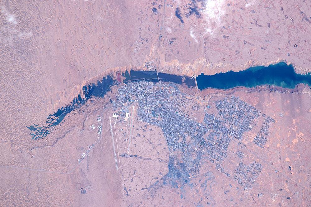

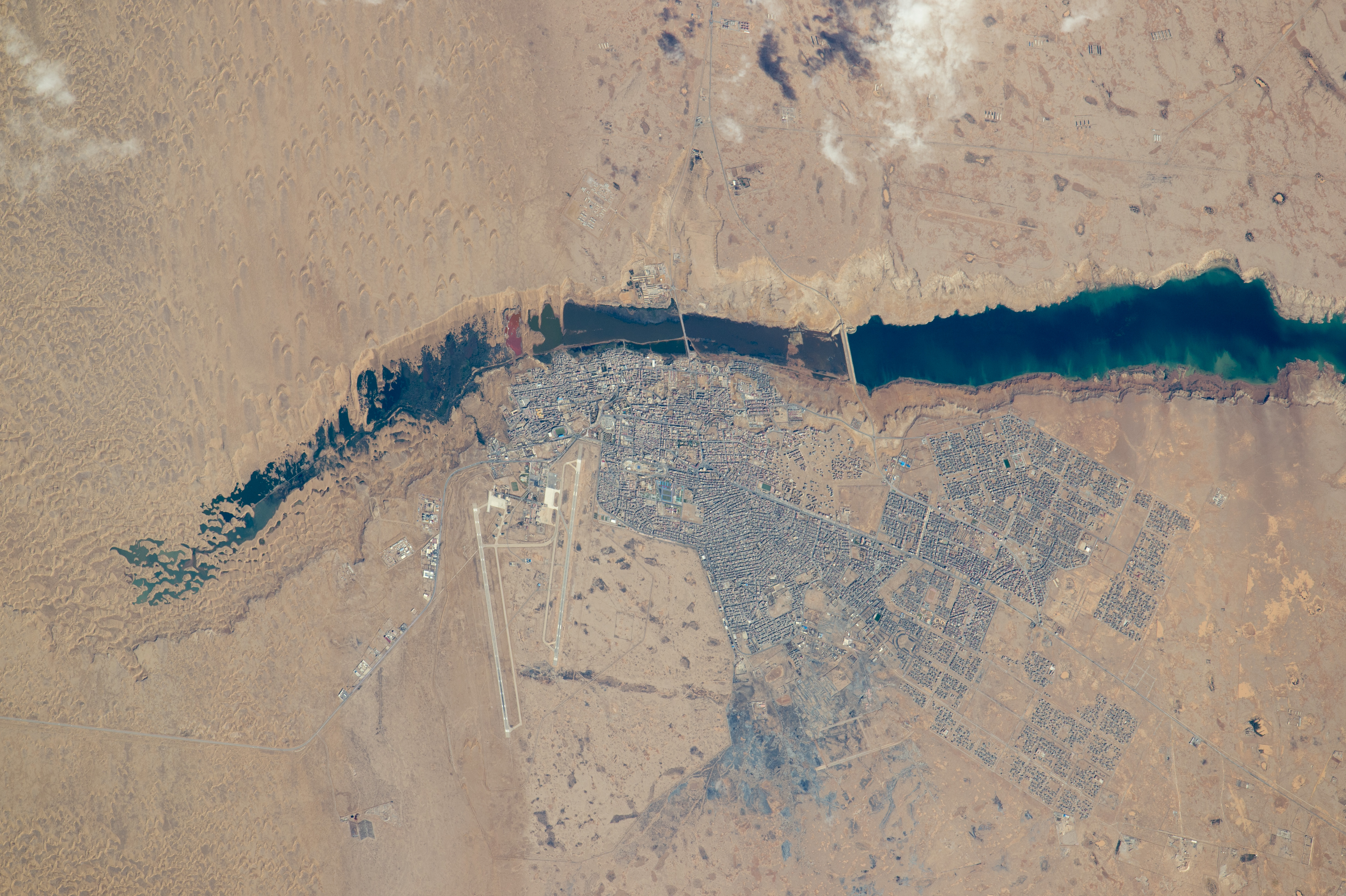
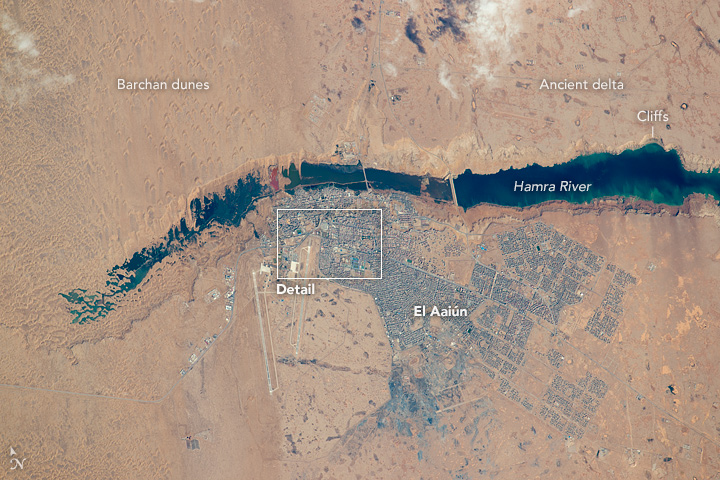
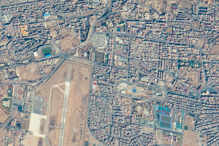
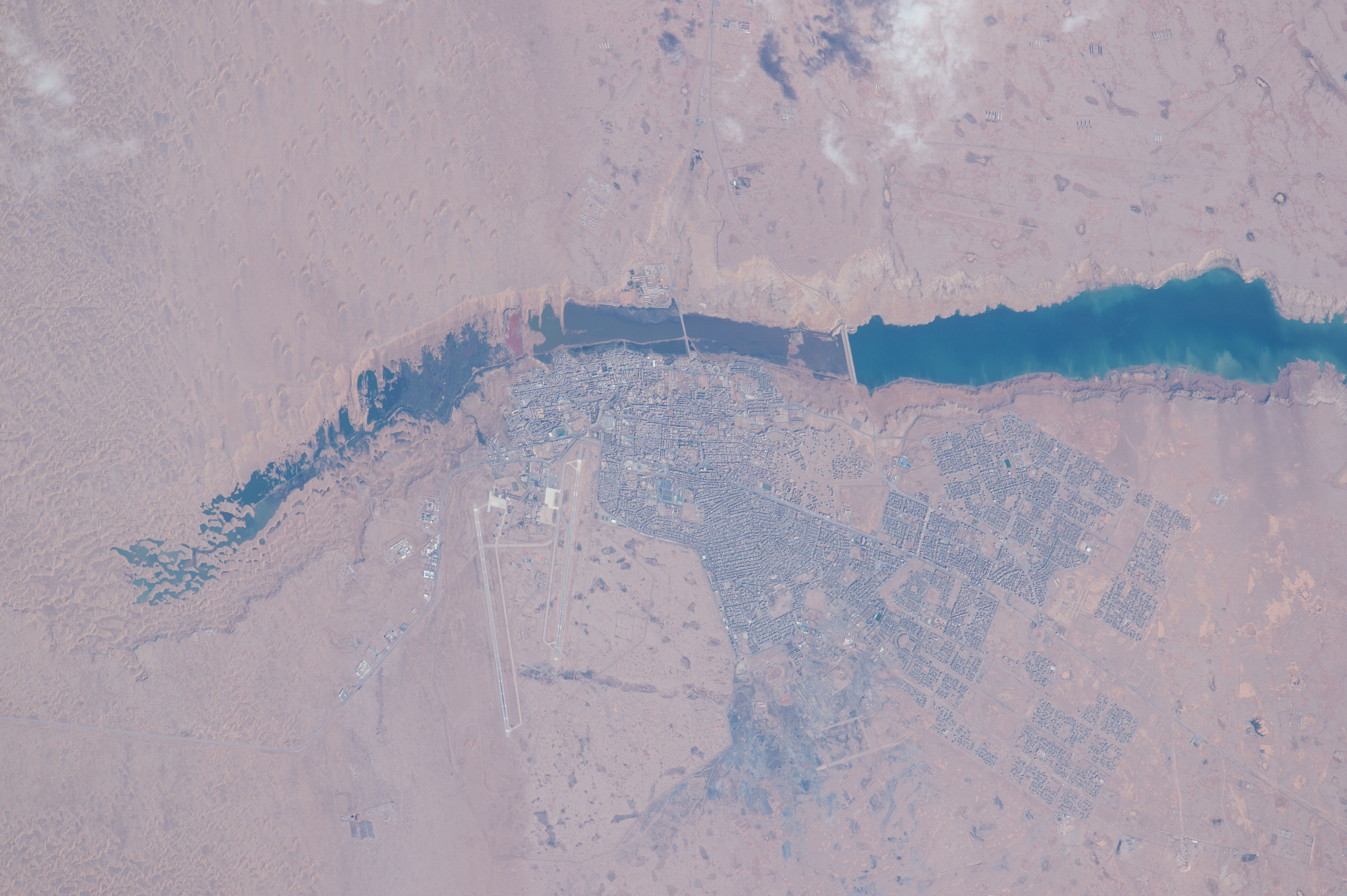


Photo center point: 27.1° N, 13.2° W
Photo center point by machine learning:
Country or Geographic Name: | WESTERN SAHARA |
Features: | EL AAIUN, AL HAMRA R., AIRSTRIP, DUNES |
| Features Found Using Machine Learning: | |
Cloud Cover Percentage: | 10 (1-10)% |
Sun Elevation Angle: | 42° |
Sun Azimuth: | 140° |
Camera: | Nikon D4 Electronic Still Camera |
Focal Length: | 1150mm |
Camera Tilt: | 34 degrees |
Format: | 4928E: 4928 x 3280 pixel CMOS sensor, 36.0mm x 23.9mm, total pixels: 16.6 million, Nikon FX format |
Film Exposure: | |
| Additional Information | |
| Width | Height | Annotated | Cropped | Purpose | Links |
|---|---|---|---|---|---|
| 1000 pixels | 666 pixels | No | No | Earth From Space collection | Download Image |
| 540 pixels | 360 pixels | Yes | No | Earth From Space collection | Download Image |
| 4928 pixels | 3280 pixels | No | No | NASA's Earth Observatory web site | Download Image |
| 720 pixels | 480 pixels | Yes | No | NASA's Earth Observatory web site | Download Image |
| 720 pixels | 480 pixels | Yes | Yes | NASA's Earth Observatory web site | Download Image |
| 4928 pixels | 3280 pixels | No | No | Download Image | |
| 640 pixels | 426 pixels | No | No | Download Image |
The photograph was taken with the most powerful lens aboard the space station, and city blocks are easily detected in the gray cityscape. Even the white landing-marker lines on the airfield runways are visible, showing that the astronaut perfectly synchronized the camera's view-finder with the moving target. This allowed for one the best ground resolutions that can be achieved from the ISS: close to 3 meters per pixel.
Small horn-shaped dunes are visible at the top left of the top image. The horns of these crescent dunes point south in the direction of dune movement. Sand from the dunes falls down the cliffs, making a spiky shoreline at the west end of the lake, and the dune field effectively prevents the river from reaching the sea. The dunes also restrict the westward expansion of the town. But scattered developments occupy an ancient delta of the river (top right) on more stable ground, where darker patches still indicate prior courses of the river.
Related Images
- NASA Earth Observatory (2014, June 30) Desert Coast - Morocco, Western Sahara.
