ISS045-E-167797
| NASA Photo ID | ISS045-E-167797 |
| Focal Length | 800mm |
| Date taken | 2015.12.03 |
| Time taken | 06:58:19 GMT |
720 x 480 pixels 4928 x 3280 pixels 4928 x 3280 pixels 640 x 426 pixels
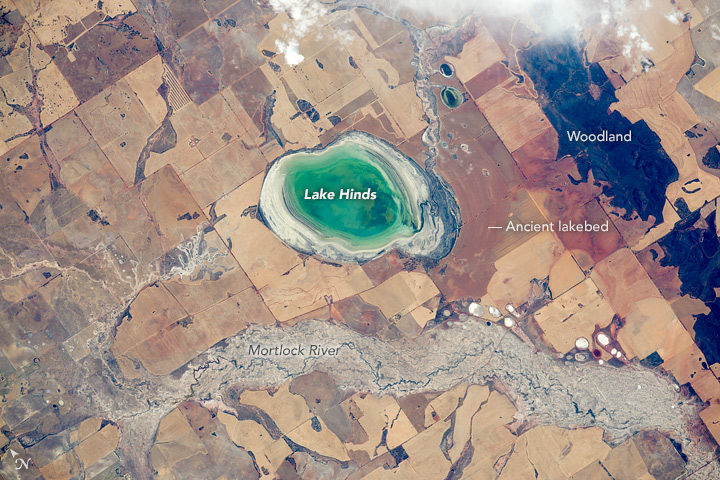
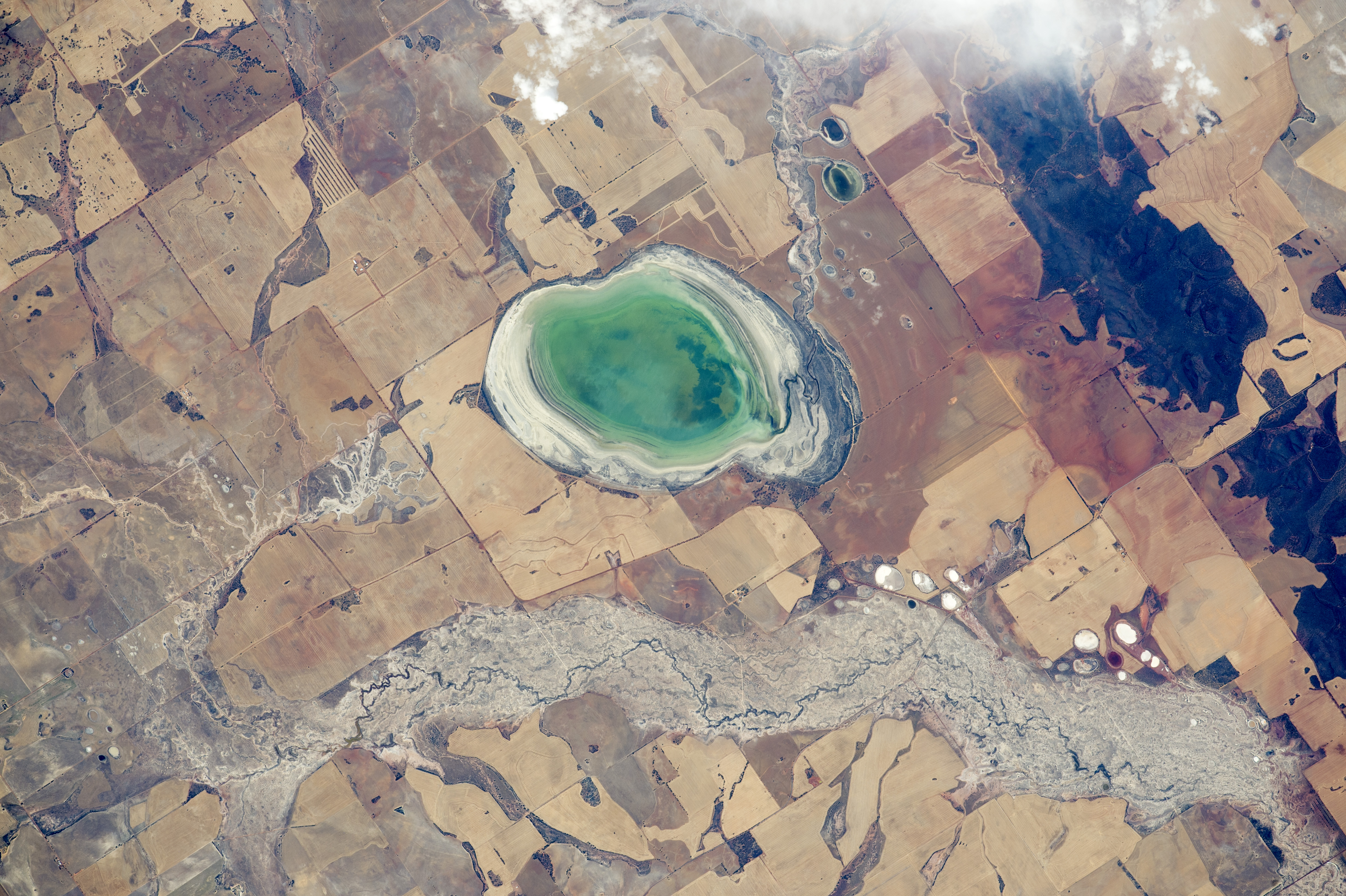


Photo center point: 30.8° S, 116.6° E
Photo center point by machine learning:
Country or Geographic Name: | AUSTRALIA-WA |
Features: | L. HINDS, MORTLOCK RIVER, AGR. |
| Features Found Using Machine Learning: | |
Cloud Cover Percentage: | 10 (1-10)% |
Sun Elevation Angle: | 50° |
Sun Azimuth: | 270° |
Camera: | Nikon D4 Electronic Still Camera |
Focal Length: | 800mm |
Camera Tilt: | 18 degrees |
Format: | 4928E: 4928 x 3280 pixel CMOS sensor, 36.0mm x 23.9mm, total pixels: 16.6 million, Nikon FX format |
Film Exposure: | |
| Additional Information | |
| Width | Height | Annotated | Cropped | Purpose | Links |
|---|---|---|---|---|---|
| 720 pixels | 480 pixels | Yes | No | Earth From Space collection | Download Image |
| 4928 pixels | 3280 pixels | No | No | NASA's Earth Observatory web site | Download Image |
| 4928 pixels | 3280 pixels | No | No | Download Image | |
| 640 pixels | 426 pixels | No | No | Download Image |
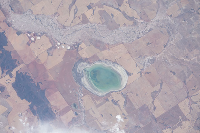
Using a powerful lens, an astronaut aboard the International Space Station photographed this small but eye-catching dry lake not far from Perth, Australia. The modern lake floor is only 5 kilometers in length and it is usually dry, with an exposed bed of white salt. But green water in this view indicates that recent rains had partly filled the lake. In this increasingly arid inland sector of the wheat belt, the Mortlock River carries more dissolved salt than other rivers in the area.
Smooth-edged, dry lake beds are well-known features of the landscape in Australia. Numerous "bath-tub rings" show the prior water levels in the lake. It was once much larger, as shown by another series of parallel, hard-to-detect rings east of the lake. Today this ancient lake floor is among the most fertile agricultural parcels in the area.
Most of Australia is arid or semi-arid, such that agriculture is mostly limited to the continent's wet margins. In this slightly wetter, southwest region around Perth, rectangular wheat fields (aligned north-south) are densely packed. Not very far to the east, all agriculture stops and large sheep ranches dominate the land use. The hilly country of Mount Matilda and Mount O'Brien remain wooded because they are too rough to plough.
