ISS043-E-303045
| NASA Photo ID | ISS043-E-303045 |
| Focal Length | 1150mm |
| Date taken | 2015.06.10 |
| Time taken | 14:12:16 GMT |
1000 x 666 pixels 540 x 360 pixels 2464 x 1640 pixels 720 x 480 pixels 4928 x 3280 pixels 640 x 426 pixels


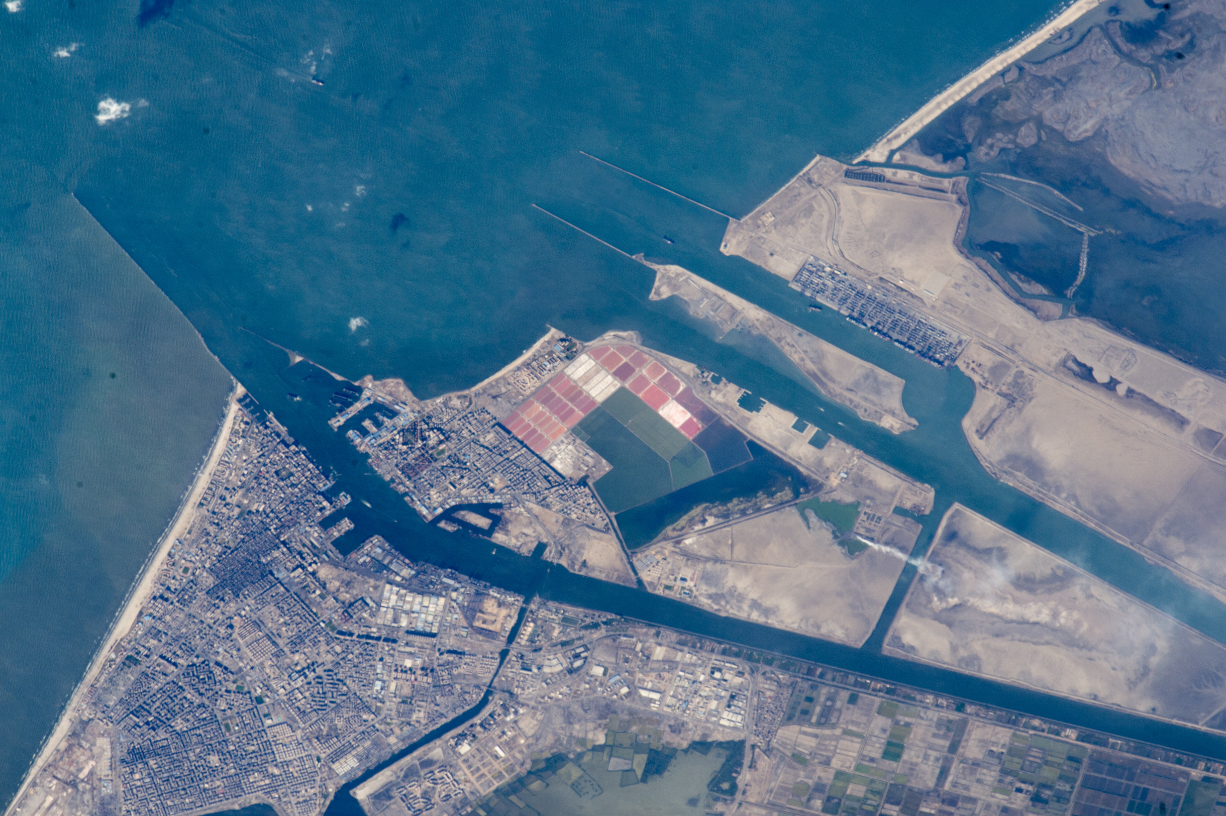


Photo center point: 31.2° N, 32.3° E
Photo center point by machine learning:
Country or Geographic Name: | EGYPT |
Features: | SUEZ CANAL, PORT SAID, PORT FUAD |
| Features Found Using Machine Learning: | |
Cloud Cover Percentage: | 10 (1-10)% |
Sun Elevation Angle: | 30° |
Sun Azimuth: | 280° |
Camera: | Nikon D4 Electronic Still Camera |
Focal Length: | 1150mm |
Camera Tilt: | 37 degrees |
Format: | 4928E: 4928 x 3280 pixel CMOS sensor, 36.0mm x 23.9mm, total pixels: 16.6 million, Nikon FX format |
Film Exposure: | |
| Additional Information | |
| Width | Height | Annotated | Cropped | Purpose | Links |
|---|---|---|---|---|---|
| 1000 pixels | 666 pixels | No | No | Earth From Space collection | Download Image |
| 540 pixels | 360 pixels | Yes | No | Earth From Space collection | Download Image |
| 2464 pixels | 1640 pixels | No | No | NASA's Earth Observatory web site | Download Image |
| 720 pixels | 480 pixels | Yes | No | NASA's Earth Observatory web site | Download Image |
| 4928 pixels | 3280 pixels | No | No | Download Image | |
| 640 pixels | 426 pixels | No | No | Download Image |
Georeferenced by human interaction - exported 2016-08-24-034216-UTC
Georeferenced by human interaction - exported 2018-01-16-185745-UTC
An explanation of the georeference file(s) above
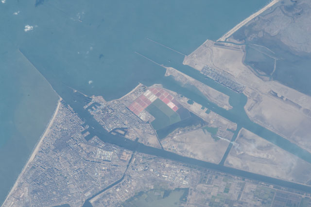
With a powerful lens, an astronaut aboard the International Space Station photographed the detail of the north end of the Suez Canal, with the city centers and port facilities of Port Said and Port Fuad (image left center). The angular shapes of docks can be seen where local ship traffic can take on and discharge cargo. The long breakwater (image left) protects shipping entering the canal from the prevailing westerly winds and waves. Muddy, light-brown water from the Nile delta (out of the image left) banks up against the west side of the breakwater (left margin of the image).
Both ports lie on the west fork of the canal. The east fork (image right) was specifically built to allow ships on long hauls--typically between Europe via the Mediterranean Sea and Asia--to avoid congestion at the west-fork ports. In 2014 Egypt announced plans to dig another canal parallel with the present canal to further ease congestion, because canal tolls provide much needed foreign exchange for Egypt. Present plans however only include a parallel canal covering half the 100 mile (160 km) length of the canal.
Other images of the area show the versatility of astronaut photography. More oblique images and shorter lenses give wider views. And images taken looking near the sun's reflection point reveal exotic patterns that show water bodies, water circulation and the highly reflective surfactant films (natural and human oils) that cover sea surfaces.
