ISS043-E-175665
| NASA Photo ID | ISS043-E-175665 |
| Focal Length | 22mm |
| Date taken | 2015.05.06 |
| Time taken | 17:13:16 GMT |
Resolutions offered for this image:
1000 x 728 pixels 540 x 401 pixels 4928 x 3280 pixels 720 x 480 pixels 720 x 480 pixels 3280 x 4928 pixels 426 x 640 pixels
1000 x 728 pixels 540 x 401 pixels 4928 x 3280 pixels 720 x 480 pixels 720 x 480 pixels 3280 x 4928 pixels 426 x 640 pixels

Spacecraft nadir point: 46.3° N, 66.7° W
Photo center point: 45.5° N, 64.5° W
Photo center point by machine learning:
Photo center point: 45.5° N, 64.5° W
Photo center point by machine learning:
Nadir to Photo Center: East
Spacecraft Altitude: 215 nautical miles (398km)
Country or Geographic Name: | CANADA-NB |
Features: | PRINCE EDWARD I., G. SAINT LAWRENCE |
| Features Found Using Machine Learning: | |
Cloud Cover Percentage: | 25 (11-25)% |
Sun Elevation Angle: | 59° |
Sun Azimuth: | 203° |
Camera: | Nikon D4 Electronic Still Camera |
Focal Length: | 22mm |
Camera Tilt: | 33 degrees |
Format: | 4928E: 4928 x 3280 pixel CMOS sensor, 36.0mm x 23.9mm, total pixels: 16.6 million, Nikon FX format |
Film Exposure: | |
| Additional Information | |
| Width | Height | Annotated | Cropped | Purpose | Links |
|---|---|---|---|---|---|
| 1000 pixels | 728 pixels | No | Yes | Earth From Space collection | Download Image |
| 540 pixels | 401 pixels | Yes | Yes | Earth From Space collection | Download Image |
| 4928 pixels | 3280 pixels | No | Yes | NASA's Earth Observatory web site | Download Image |
| 720 pixels | 480 pixels | Yes | No | NASA's Earth Observatory web site | Download Image |
| 720 pixels | 480 pixels | Yes | Yes | NASA's Earth Observatory web site | Download Image |
| 3280 pixels | 4928 pixels | No | No | Download Image | |
| 426 pixels | 640 pixels | No | No | Download Image |
Download Packaged File
Download a Google Earth KML for this Image
View photo footprint information
Download a GeoTIFF for this photo
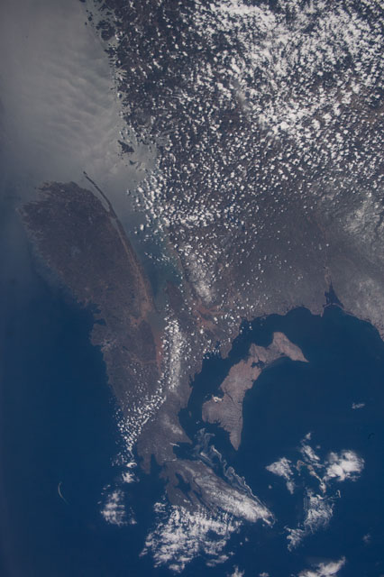
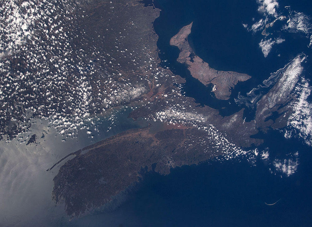
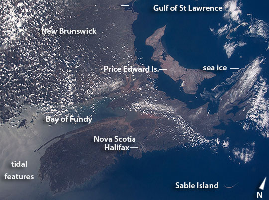
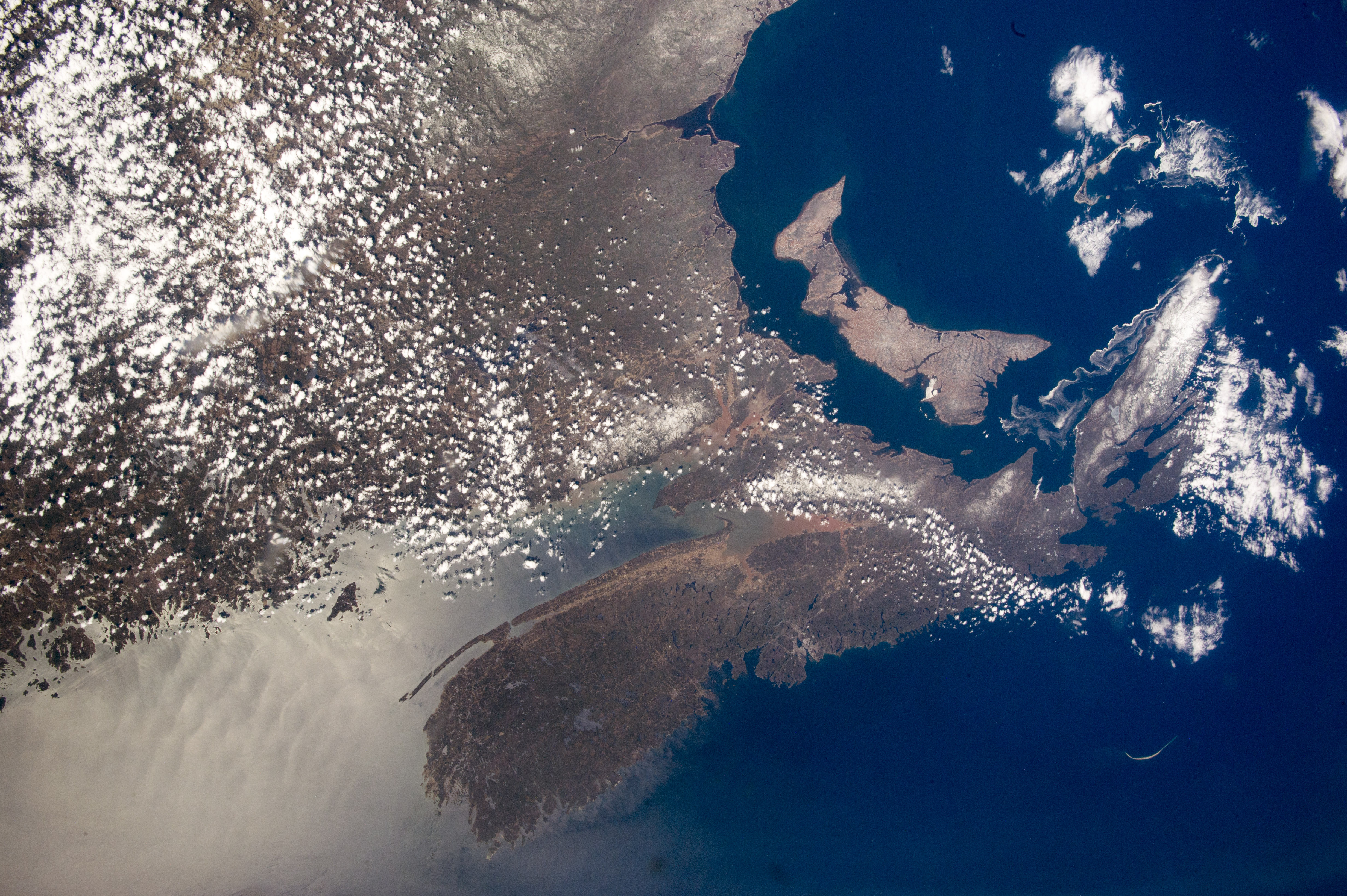
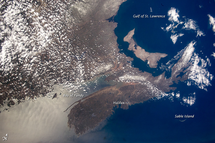
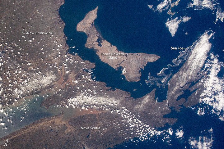
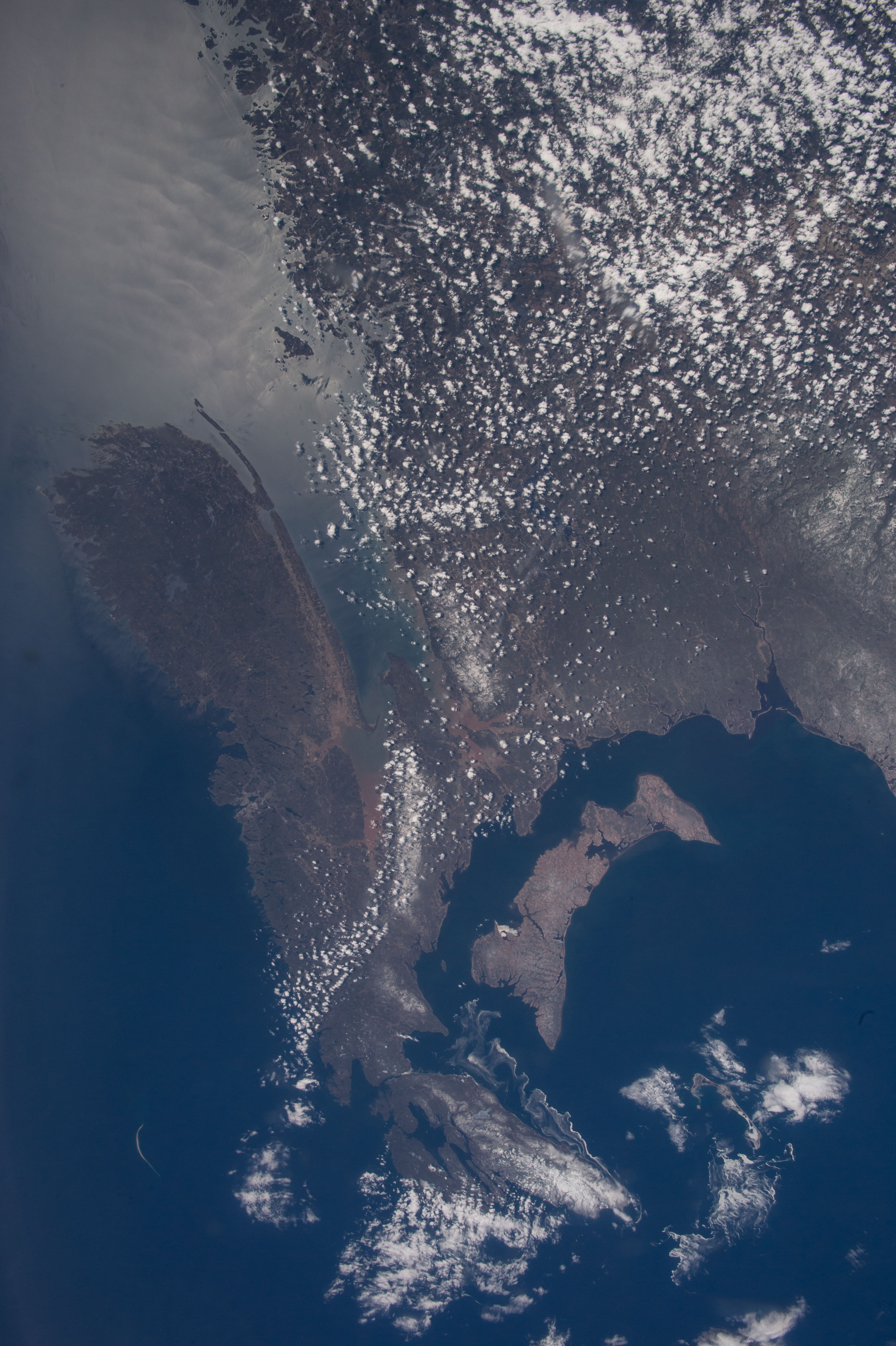
Image Caption: Nova Scotia, Prince Edward Island, Canada
Astronauts aboard the International Space Station took this near-vertical image with a "wide-angle" lens--the same focal length as the human eye, showing what crews actually see. The view shows the characteristic coastlines of the Nova Scotia peninsula on Canada's eastern seaboard, separated from the mainland by the Bay of Fundy (image center). The bay experiences the largest tidal fluctuations (~16 m, 50 feet) in the world. The enormous exchange of water twice a day is partly responsible for the red sediment visible in the headwaters of the bay. Timber-cuts make the linear patterns on the eastern part of the boat-shaped province of Prince Edward Island (image center right) in the Gulf of St Lawrence. This is Canada's smallest and only island province. A long tendril of sea ice streams south from Nova Scotia's clouded, northernmost cape (image top right). The bright reflection of the sun (image upper left) shows intersecting tidal features in the sea surface resulting from both the Fundy tides and those tides propagating in from the Atlantic Ocean.
Cities are difficult to see from space in daylight hours. Of the many cities that would appear in night views of the area, only Nova Scotia's capital, Halifax, stands out with any clarity against the dark landscape and sea surface. Two hundred and ninety km (180 mi) northeast of Halifax the sand spit known as Sable Island is a prominent shape well known to astronauts who often take photos of the island (image lower left). This sweep of sand, 35 km from tip to tip (22 mi), has only five inhabitants, but receives visits from tourists as one of Canada's national parks.
