ISS043-E-101541

| NASA Photo ID | ISS043-E-101541 |
| Focal Length | 800mm |
| Date taken | 2015.04.10 |
| Time taken | 22:52:23 GMT |
1000 x 666 pixels 540 x 360 pixels 4928 x 3280 pixels 720 x 480 pixels 4928 x 3280 pixels 640 x 426 pixels
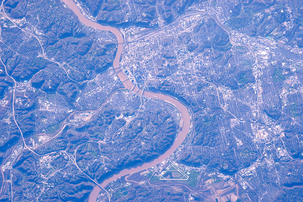
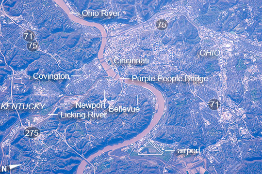
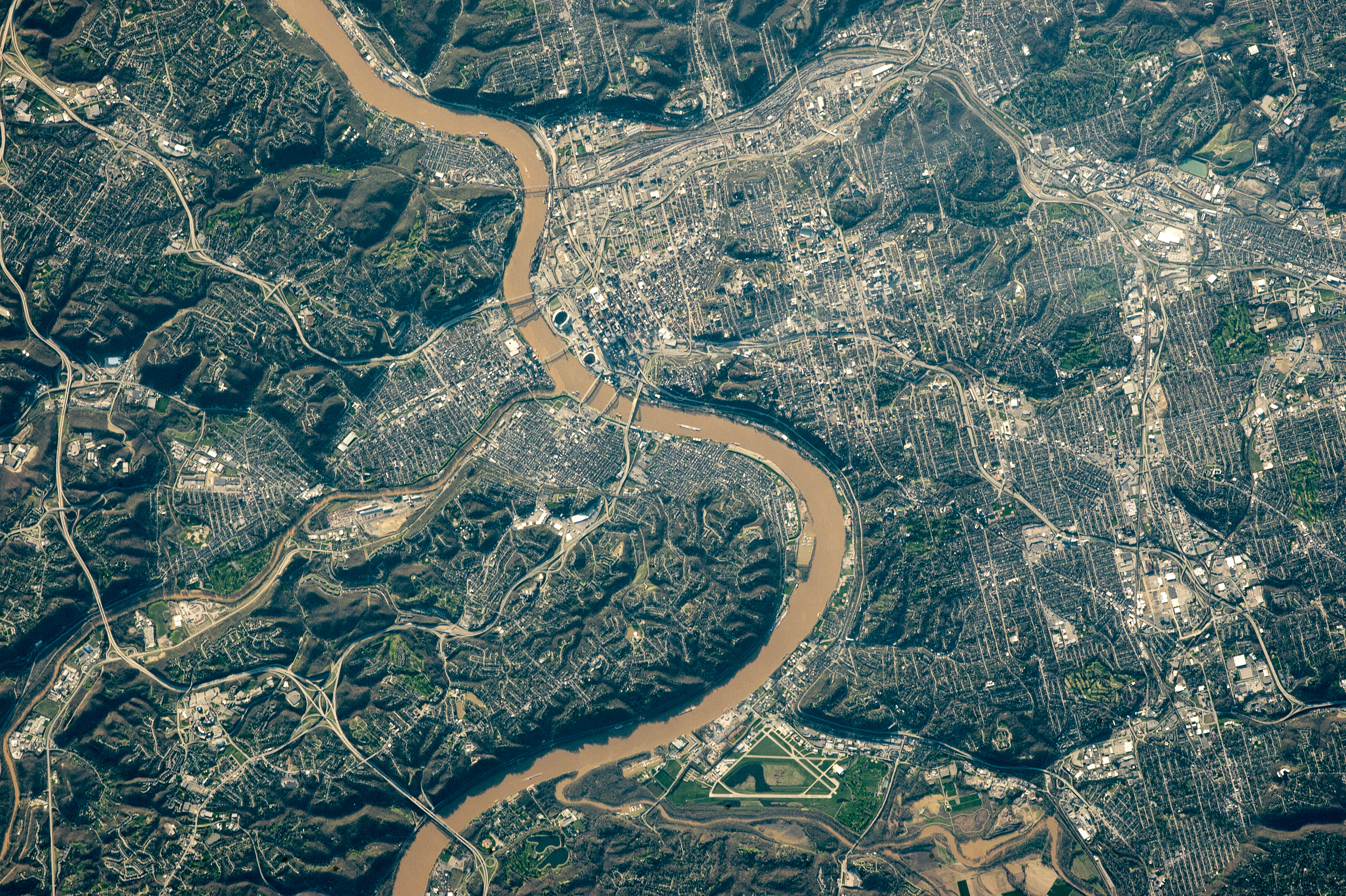
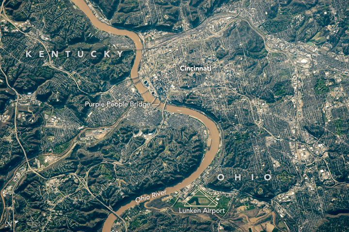
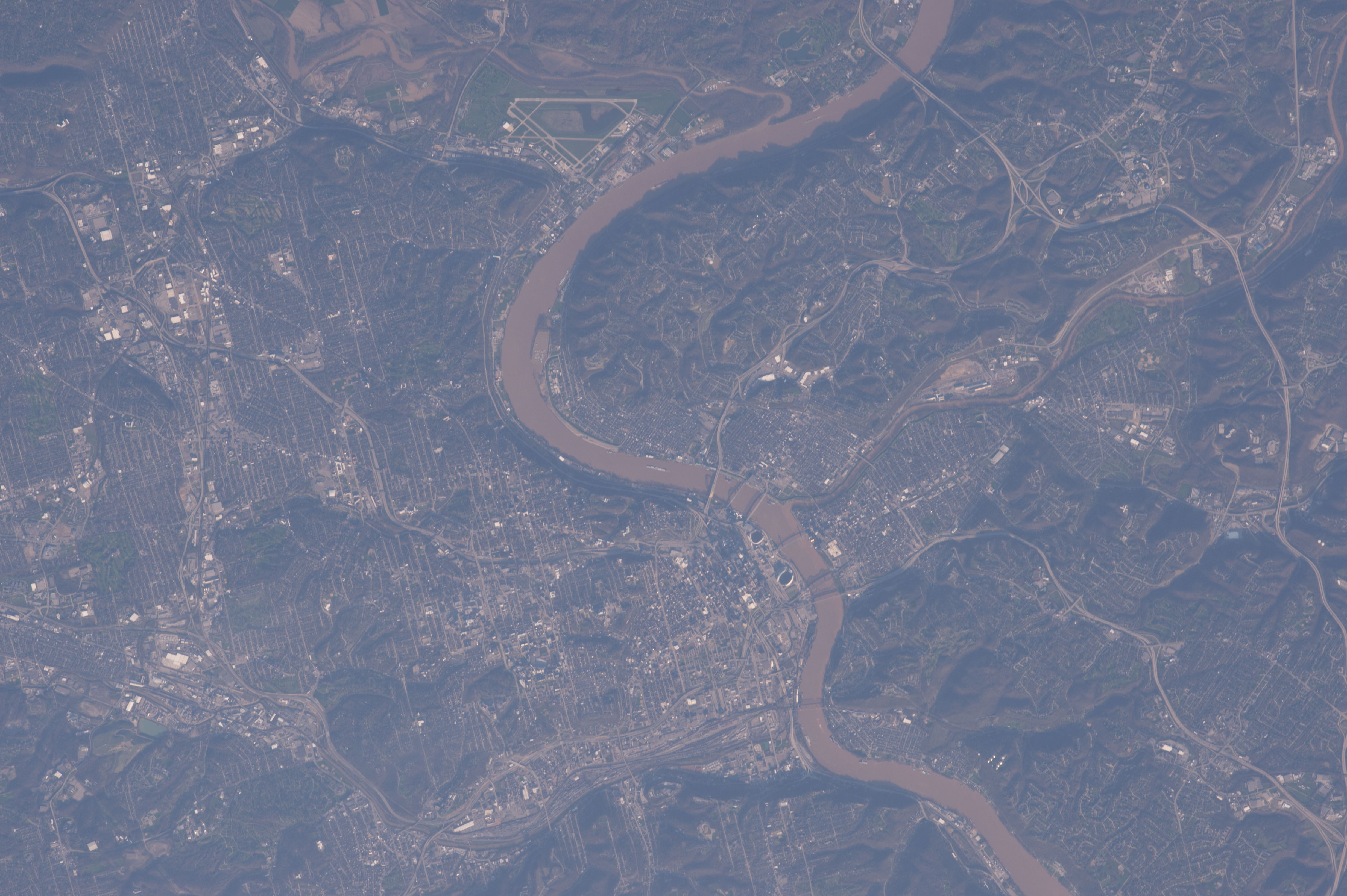


Photo center point: 39.1° N, 84.5° W
Photo center point by machine learning:
Country or Geographic Name: | USA-OHIO |
Features: | CINCINNATI, OHIO R., BRIDGES |
| Features Found Using Machine Learning: | |
Cloud Cover Percentage: | 0 (no clouds present) |
Sun Elevation Angle: | 12° |
Sun Azimuth: | 270° |
Camera: | Nikon D4 Electronic Still Camera |
Focal Length: | 800mm |
Camera Tilt: | 33 degrees |
Format: | 4928E: 4928 x 3280 pixel CMOS sensor, 36.0mm x 23.9mm, total pixels: 16.6 million, Nikon FX format |
Film Exposure: | |
| Additional Information | |
| Width | Height | Annotated | Cropped | Purpose | Links |
|---|---|---|---|---|---|
| 1000 pixels | 666 pixels | No | No | Earth From Space collection | Download Image |
| 540 pixels | 360 pixels | Yes | No | Earth From Space collection | Download Image |
| 4928 pixels | 3280 pixels | No | No | NASA's Earth Observatory web site | Download Image |
| 720 pixels | 480 pixels | Yes | No | NASA's Earth Observatory web site | Download Image |
| 4928 pixels | 3280 pixels | No | No | Download Image | |
| 640 pixels | 426 pixels | No | No | Download Image |
Astronauts on board the International Space Station recognized the large Ohio River with its sweeping bends and brown color. Cincinnati's downtown zone--centered on the river bluffs (at image upper center right) at the point where the small Licking River meets the Ohio--is harder to see because cities are gray and low-contrast features. The urban zone spills onto the Kentucky side of the river as the towns of Covington, Newport and Bellevue (image center left). Green suburbs beyond these downtowns are even harder to detect in this early summer shot. Straight lines of the street grid pattern (and curved lines in some subdivisions, as at image top right) show the real extent of the cities, and cover the entire the area represented by the image (325 sq km, 125 sq mi) but extend much further.
Steep bluffs cast long shadows onto the river, especially opposite the airport (at image lower center). The ovals of two stadiums lie on the Cincinnati river bank, one for the Cincinnati Bengals (upper stadium) and the Cincinnati Reds (lower stadium), the bowls in deep shadow in the late afternoon sun. A barge near the bridges makes its way downstream (at image center)--especially clear in the detailed view.
Three of Cincinnati's nine bridges over the Ohio River carry highway traffic (Highways 71, 75 and 275). For space-borne observers, near-vertical views like this one can make mountains--and bridges--seem flatter. Here the combination of a powerful lens and low sun angles reveal the outlines of the bridges as seen in their shadows projected onto the river surface--showing single and multi-span bridge designs, and even the number of pillars that support each bridge. A pedestrian bridge, one of the few in the US, is the Newport Southbank Bridge, popularly known as the Purple People Bridge (a color decided on following responses from more than a dozen focus groups).
