ISS041-E-111072
| NASA Photo ID | ISS041-E-111072 |
| Focal Length | 800mm |
| Date taken | 2014.11.07 |
| Time taken | 11:00:10 GMT |
Resolutions offered for this image:
1000 x 666 pixels 540 x 360 pixels 2464 x 1640 pixels 720 x 480 pixels 4928 x 3280 pixels 640 x 426 pixels
1000 x 666 pixels 540 x 360 pixels 2464 x 1640 pixels 720 x 480 pixels 4928 x 3280 pixels 640 x 426 pixels


Spacecraft nadir point: 32.4° N, 47.8° E
Photo center point: 30.9° N, 47.9° E
Photo center point by machine learning:
Photo center point: 30.9° N, 47.9° E
Photo center point by machine learning:
Nadir to Photo Center: South
Spacecraft Altitude: 222 nautical miles (411km)
Country or Geographic Name: | IRAQ |
Features: | LAND FORTIFICATIONS |
| Features Found Using Machine Learning: | |
Cloud Cover Percentage: | 10 (1-10)% |
Sun Elevation Angle: | 30° |
Sun Azimuth: | 222° |
Camera: | Nikon D4 Electronic Still Camera |
Focal Length: | 800mm |
Camera Tilt: | 22 degrees |
Format: | 4928E: 4928 x 3280 pixel CMOS sensor, 36.0mm x 23.9mm, total pixels: 16.6 million, Nikon FX format |
Film Exposure: | |
| Additional Information | |
| Width | Height | Annotated | Cropped | Purpose | Links |
|---|---|---|---|---|---|
| 1000 pixels | 666 pixels | No | No | Earth From Space collection | Download Image |
| 540 pixels | 360 pixels | Yes | No | Earth From Space collection | Download Image |
| 2464 pixels | 1640 pixels | No | No | NASA's Earth Observatory web site | Download Image |
| 720 pixels | 480 pixels | Yes | No | NASA's Earth Observatory web site | Download Image |
| 4928 pixels | 3280 pixels | No | No | Download Image | |
| 640 pixels | 426 pixels | No | No | Download Image |
Download Packaged File
Download a Google Earth KML for this Image
View photo footprint information
Download a GeoTIFF for this photo
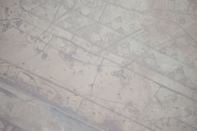
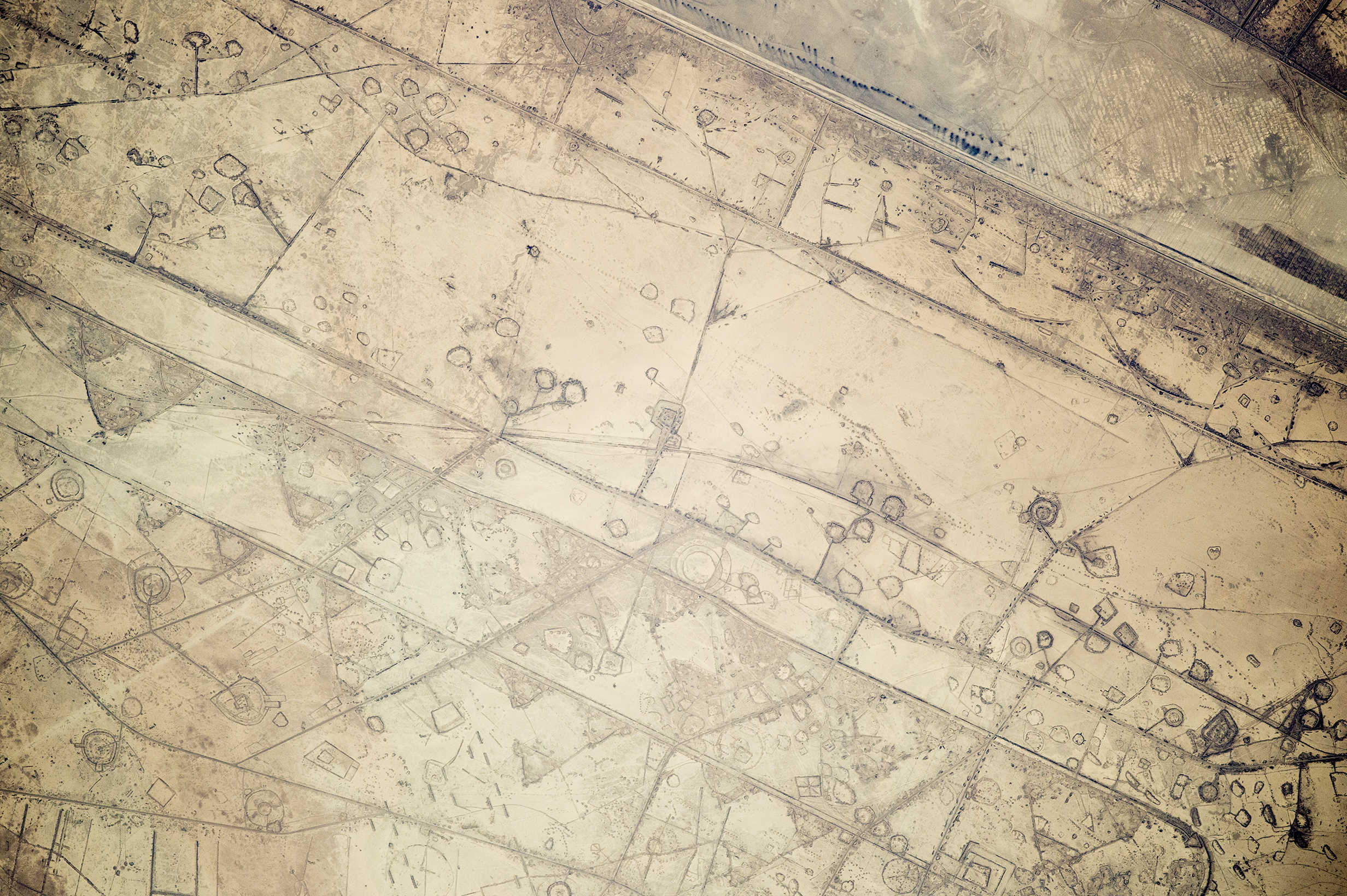
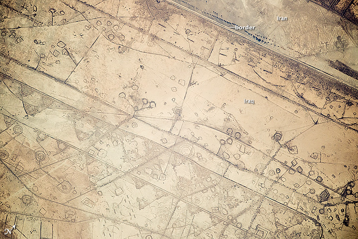
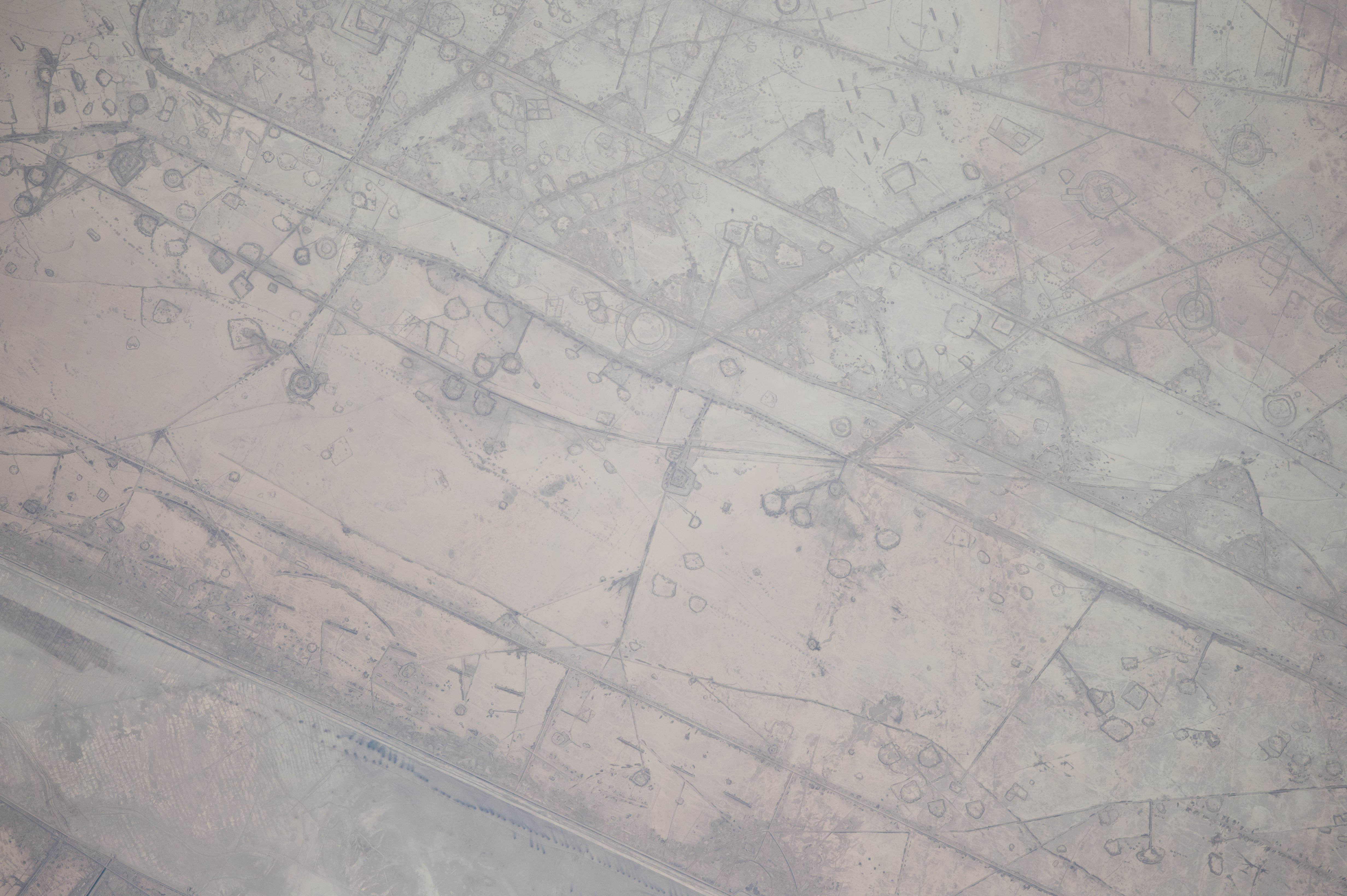
Image Caption: Astronauts aboard the International Space Station took this photograph of land fortifications along a 20-kilometer (12-mile) stretch of the Iraq-Iran border, near the coast of the Persian Gulf. Systems of large curved earthworks, circular gun emplacements, and straight connecting roads run parallel to the international border.
First thought by the ISS team to be oil-pad installations, the strategic location of these formations along the international boundary made it easier to see these as patterns of military fortifications. This region of oil refining and exporting was the center of numerous military actions during the war in the 1980s, especially during the defense of the southern city of Basra. The similarity to oil-pad patterns is apparent in May 2006 astronaut photos of West Texas that you can see here and here.
First thought by the ISS team to be oil-pad installations, the strategic location of these formations along the international boundary made it easier to see these as patterns of military fortifications. This region of oil refining and exporting was the center of numerous military actions during the war in the 1980s, especially during the defense of the southern city of Basra. The similarity to oil-pad patterns is apparent in May 2006 astronaut photos of West Texas that you can see here and here.
