ISS041-E-102204
| NASA Photo ID | ISS041-E-102204 |
| Focal Length | 210mm |
| Date taken | 2014.10.26 |
| Time taken | 05:05:48 GMT |
1000 x 666 pixels 540 x 360 pixels 4928 x 3280 pixels 720 x 480 pixels 4928 x 3280 pixels 640 x 426 pixels


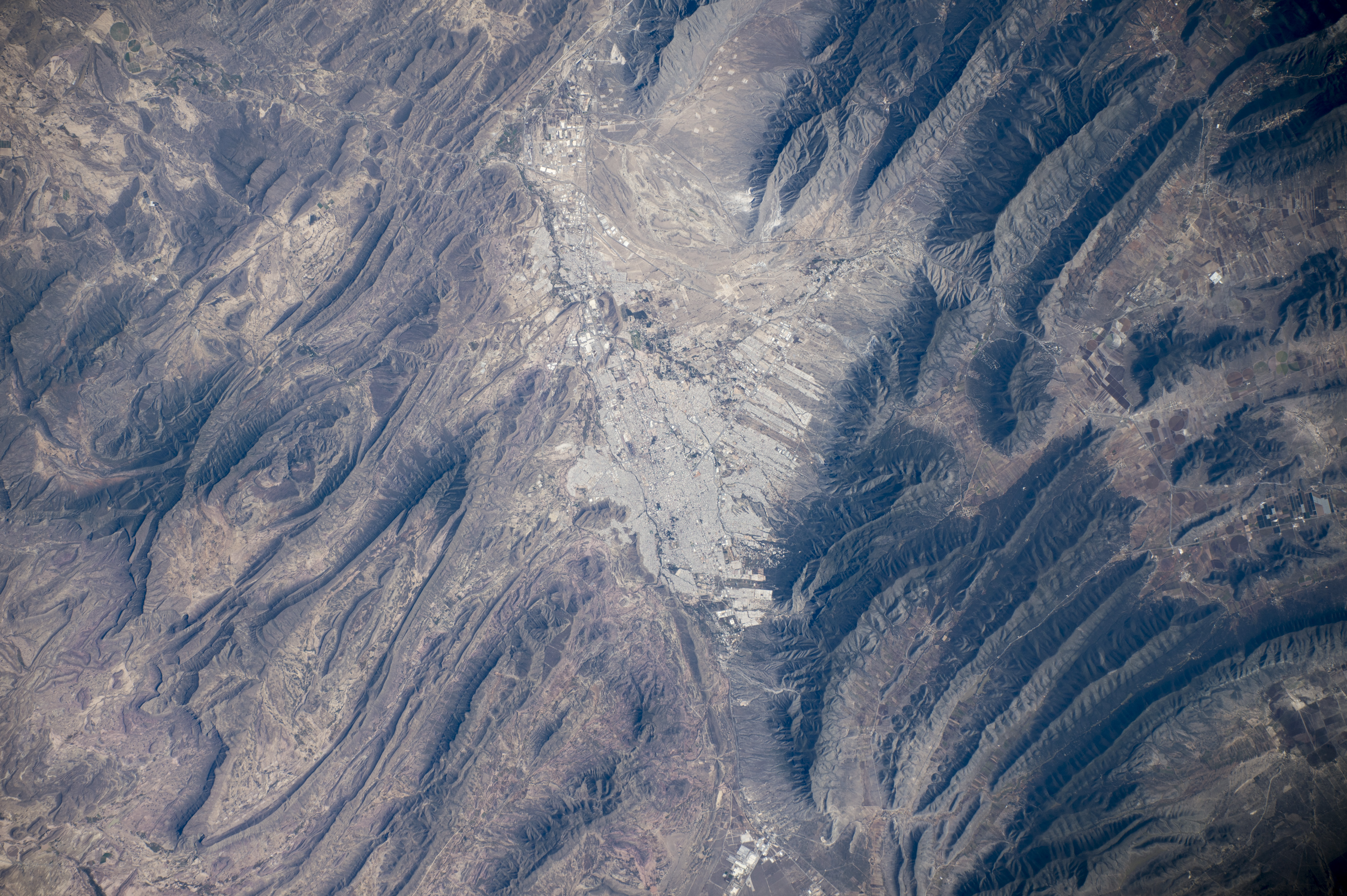
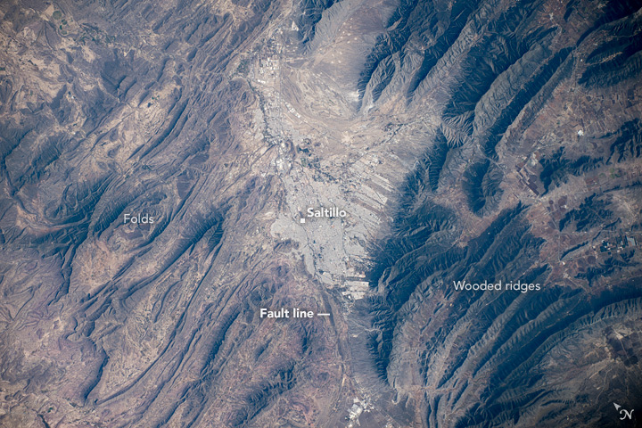

Photo center point: 25.4° N, 101.0° W
Photo center point by machine learning:
Country or Geographic Name: | MEXICO |
Features: | SALTILLO, SIERRA MADRE ORIENTAL |
| Features Found Using Machine Learning: | |
Cloud Cover Percentage: | 10 (1-10)% |
Sun Elevation Angle: | -11° |
Sun Azimuth: | 263° |
Camera: | Nikon D4 Electronic Still Camera |
Focal Length: | 210mm |
Camera Tilt: | High Oblique |
Format: | 4928E: 4928 x 3280 pixel CMOS sensor, 36.0mm x 23.9mm, total pixels: 16.6 million, Nikon FX format |
Film Exposure: | |
| Additional Information | |
| Width | Height | Annotated | Cropped | Purpose | Links |
|---|---|---|---|---|---|
| 1000 pixels | 666 pixels | No | No | Earth From Space collection | Download Image |
| 540 pixels | 360 pixels | Yes | No | Earth From Space collection | Download Image |
| 4928 pixels | 3280 pixels | No | No | NASA's Earth Observatory web site | Download Image |
| 720 pixels | 480 pixels | Yes | No | NASA's Earth Observatory web site | Download Image |
| 4928 pixels | 3280 pixels | No | No | Download Image | |
| 640 pixels | 426 pixels | No | No | Download Image |
An explanation of the georeference file(s) above
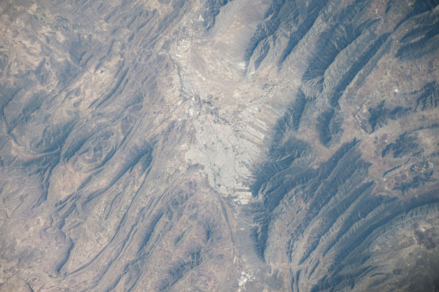
Looking down directly below the International Space Station, one of the astronauts took this image of the Mexican city of Saltillo, whose gray cityscape appears image center. The urban region (823,000 inhabitants) is the largest city in the Mexican state of Coahuila and capital of the state, sometimes called the "Athens of Mexico" for its classical architecture. Founded in 1577, it is also one of the oldest post-conquest cities in Mexico. Saltillo lies on the doorstep of the Chihuahuan Desert, which appears as the tan colors west of the city (image left).
The city obtains its water from the high, well-watered mountains to the east (image right) that reach altitudes of more than 12,000 feet (3700 m). These prominent, straight or slightly curved green ridges are the oak-covered slopes of the Sierra Madre Oriental. These characteristic ridges immediately indicate to astronauts that they are flying over northern Mexico. The distinctive topography is the result of a mountain-building event about 60 million years ago which folded and faulted thick layers of rocks, modified by later erosion. Saltillo is located on a fault zone, visible as an approximately straight line across the center of the image, that separates the Sierra from the meandering shapes of low desert hills.
