ISS040-E-017316

| NASA Photo ID | ISS040-E-017316 |
| Focal Length | 31mm |
| Date taken | 2014.06.23 |
| Time taken | 17:44:10 GMT |
Cloud masks available for this image:
Spacecraft nadir point: 47.8° N, 50.7° W
Photo center point:
Photo center point by machine learning:
Photo center point:
Photo center point by machine learning:
Nadir to Photo Center:
Spacecraft Altitude: 219 nautical miles (406km)
Country or Geographic Name: | |
Features: | |
| Features Found Using Machine Learning: | PAN- |
Cloud Cover Percentage: | 73 (51-75)% |
Sun Elevation Angle: | 53° |
Sun Azimuth: | 241° |
Camera: | NIKON D3S S/N: 2007931 |
Focal Length: | 31mm |
Camera Tilt: | |
Format: | |
Film Exposure: | |
| Additional Information | |
| Width | Height | Annotated | Cropped | Purpose | Links |
|---|---|---|---|---|---|
| 4256 pixels | 2832 pixels | No | No | Download Image | |
| 640 pixels | 426 pixels | No | No | Download Image |
Download Packaged File
Download a Google Earth KML for this Image
View photo footprint information
Download a GeoTIFF for this photo
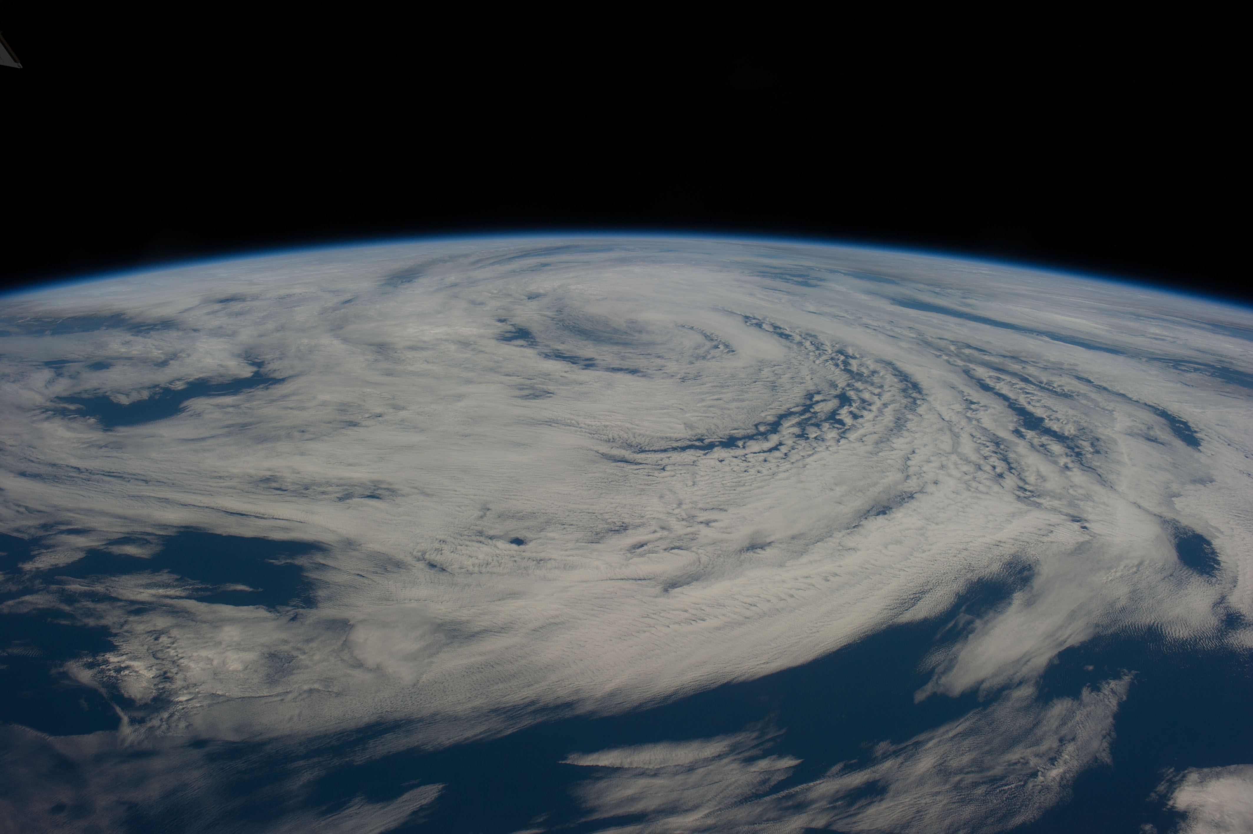
Image Caption: ISS040-E-017316 (23 June 2014) --- As the International Space Station was passing over the North Atlantic Ocean, just east of Newfoundland, on June 23, 2014, one of the Expedition 40 crew members on the orbital outpost recorded this panoramic view of the swirling bands of a mature, not dangerous non-tropical, cyclone. Such cyclonic activity is not unusual for this time of year in that area.
