ISS030-E-110900
| NASA Photo ID | ISS030-E-110900 |
| Focal Length | 28mm |
| Date taken | 2012.02.03 |
| Time taken | 05:49:42 GMT |
1000 x 741 pixels 540 x 400 pixels 4256 x 2832 pixels 720 x 480 pixels 4256 x 2832 pixels 640 x 426 pixels
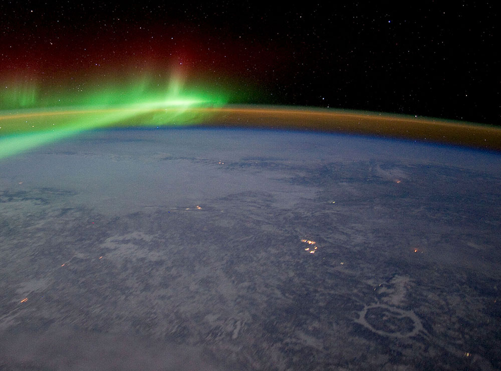
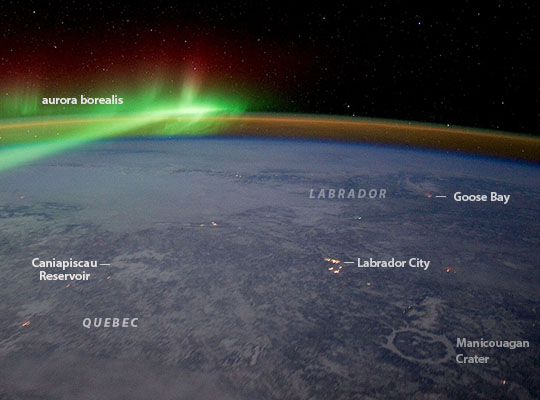
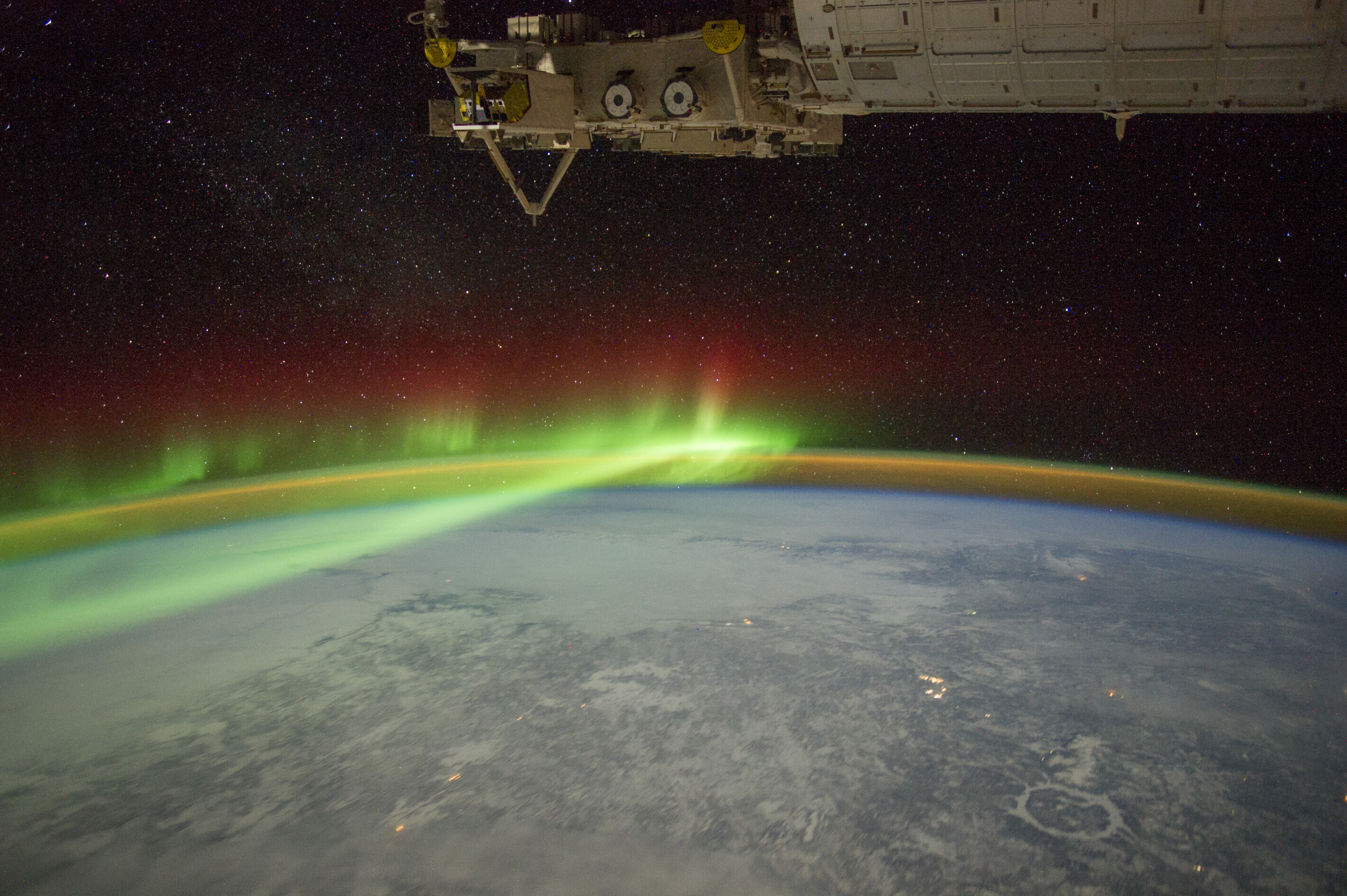
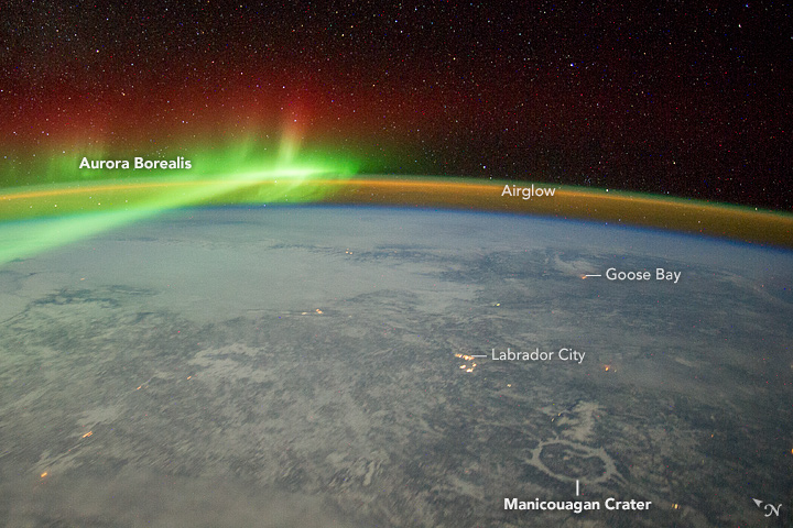
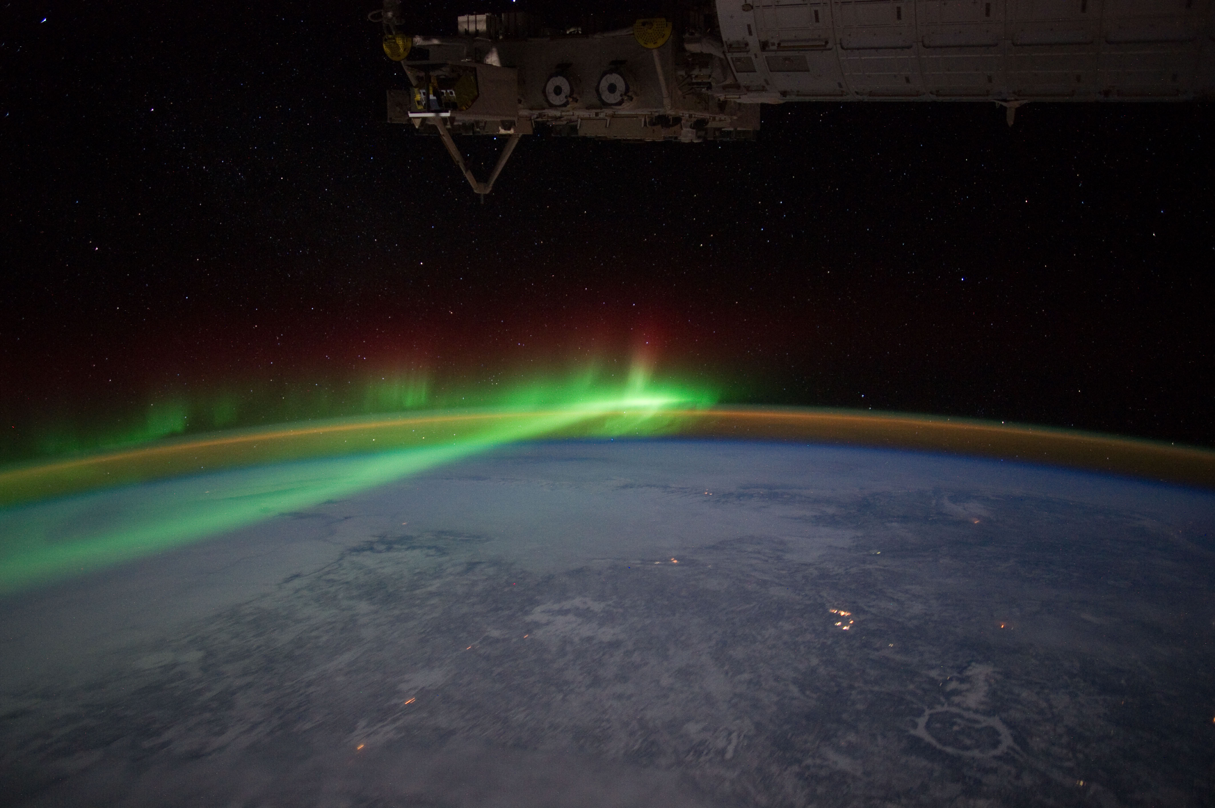
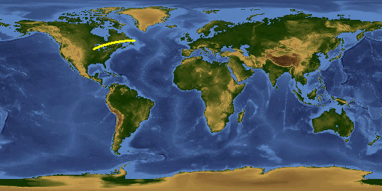
Photo center point: 55.0° N, 68.0° W
Photo center point by machine learning:
Country or Geographic Name: | CANADA-Q |
Features: | AURORA BOREALIS, ATMOSPHERIC LIMB, MANICOUAGAN RES. AT NIGHT |
| Features Found Using Machine Learning: | AURORA, PAN- |
Cloud Cover Percentage: | 25 (11-25)% |
Sun Elevation Angle: | -57° |
Sun Azimuth: | 16° |
Camera: | Nikon D3S Electronic Still Camera |
Focal Length: | 28mm |
Camera Tilt: | High Oblique |
Format: | 4256E: 4256 x 2832 pixel CMOS sensor, 36.0mm x 23.9mm, total pixels: 12.87 million, Nikon FX format |
Film Exposure: | |
| Additional Information | |
| Width | Height | Annotated | Cropped | Purpose | Links |
|---|---|---|---|---|---|
| 1000 pixels | 741 pixels | No | Yes | Earth From Space collection | Download Image |
| 540 pixels | 400 pixels | Yes | Yes | Earth From Space collection | Download Image |
| 4256 pixels | 2832 pixels | No | Yes | NASA's Earth Observatory web site | Download Image |
| 720 pixels | 480 pixels | Yes | Yes | NASA's Earth Observatory web site | Download Image |
| 4256 pixels | 2832 pixels | No | No | Download Image | |
| 640 pixels | 426 pixels | No | No | Download Image |
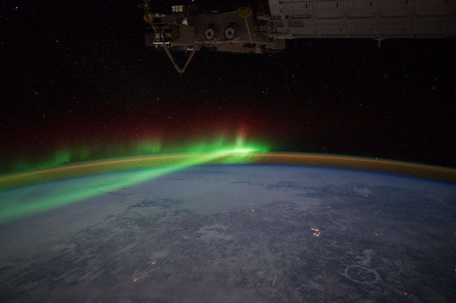
An astronaut aboard the International Space Station adjusted the camera for night imaging--and captured green veils and curtains of an aurora that spans thousands of km of Canada's northern lands. Snow and ice in this winter image reflect enough light from stars and the aurora to reveal several details of the night landscape--especially ice on the frozen reservoir that now occupies the 60-km Manicouagan impact crater (at image lower right). Another ice-covered, irregularly shaped reservoir--Caniapiscau--is more difficult to detect (at image left). City lights reveal the small towns of the region, like the iron-ore mining town of Labrador City (at image center right) and the Royal Canadian Air Force (RCAF) base Goose Bay (at image top right).
The brilliant aurora borealis is the light that glows when charged particles from the Sun collide with atoms in the atmosphere. The green and faint red colors are caused by oxygen atoms. The fainter arc of light that parallels the horizon is known as airglow. This is another, but different manifestation of the interaction of the Earth's atmosphere with radiation from the Sun.
The atmosphere shields living things on Earth's surface from the Sun's harmful radiation. It also causes small impacting asteroids to burn up in the atmosphere, or catastrophically explode like the Chelyabinsk event of 2013, before hitting the ground.
By contrast, larger asteroids are able to penetrate the atmosphere and collide with our rocky planet, with dramatic effects. Geologists now know that a large asteroid slammed into the Earth about 214 million years ago, creating a crater ~100 km across (60 miles), although the Manicouagan crater in its present form, after erosion by "recent" glaciers in the last 2 million years, is today ~60 km (37 miles) wide. The impact caused a shock wave to radiate across the Earth's surface, followed closely by high-velocity winds. Near the impact point wind speeds would have exceeded 1000 km per hour (620 miles per hour). Farther away winds would have decelerated to hurricane force. The shock wave and airblast would have severely damaged and killed plants and animals out to radial distances of approximately 560 km (350 miles)--as far as the town of Goose Bay on the Labrador Sea (at image top right)--that is, the lower half of this scene.
