STS066-114-63
| NASA Photo ID | STS066-114-63 |
| Focal Length | 100mm |
| Date taken | 1994.11.09 |
| Time taken | 17:55:00 GMT |
Resolutions offered for this image:
5276 x 5276 pixels 640 x 640 pixels 5700 x 5900 pixels 500 x 518 pixels 640 x 480 pixels
5276 x 5276 pixels 640 x 640 pixels 5700 x 5900 pixels 500 x 518 pixels 640 x 480 pixels

Cloud masks available for this image:
Spacecraft nadir point: 38.6° N, 116.5° W
Photo center point: 33.0° N, 117.5° W
Photo center point by machine learning:
Photo center point: 33.0° N, 117.5° W
Photo center point by machine learning:
Nadir to Photo Center: South
Spacecraft Altitude: 159 nautical miles (294km)
Country or Geographic Name: | USA-CALIFORNIA |
Features: | PAN-SALTON SEA, MTS., BAJA |
| Features Found Using Machine Learning: | |
Cloud Cover Percentage: | 25 (11-25)% |
Sun Elevation Angle: | 30° |
Sun Azimuth: | 154° |
Camera: | Hasselblad |
Focal Length: | 100mm |
Camera Tilt: | High Oblique |
Format: | 5046: Kodak, natural color positive, Lumiere 100/5046, ASA 100, standard base |
Film Exposure: | Normal |
| Additional Information | |
| Width | Height | Annotated | Cropped | Purpose | Links |
|---|---|---|---|---|---|
| 5276 pixels | 5276 pixels | No | No | Earth From Space collection | Download Image |
| 640 pixels | 640 pixels | No | No | Earth From Space collection | Download Image |
| 5700 pixels | 5900 pixels | No | No | Download Image | |
| 500 pixels | 518 pixels | No | No | Download Image | |
| 640 pixels | 480 pixels | No | No | Download Image |
Download Packaged File
Download a Google Earth KML for this Image
View photo footprint information
Download a GeoTIFF for this photo
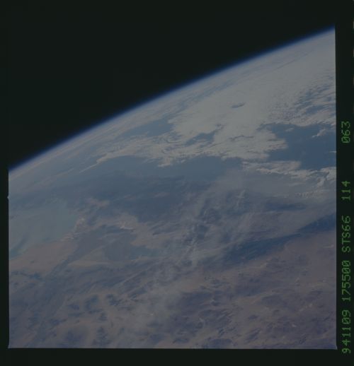
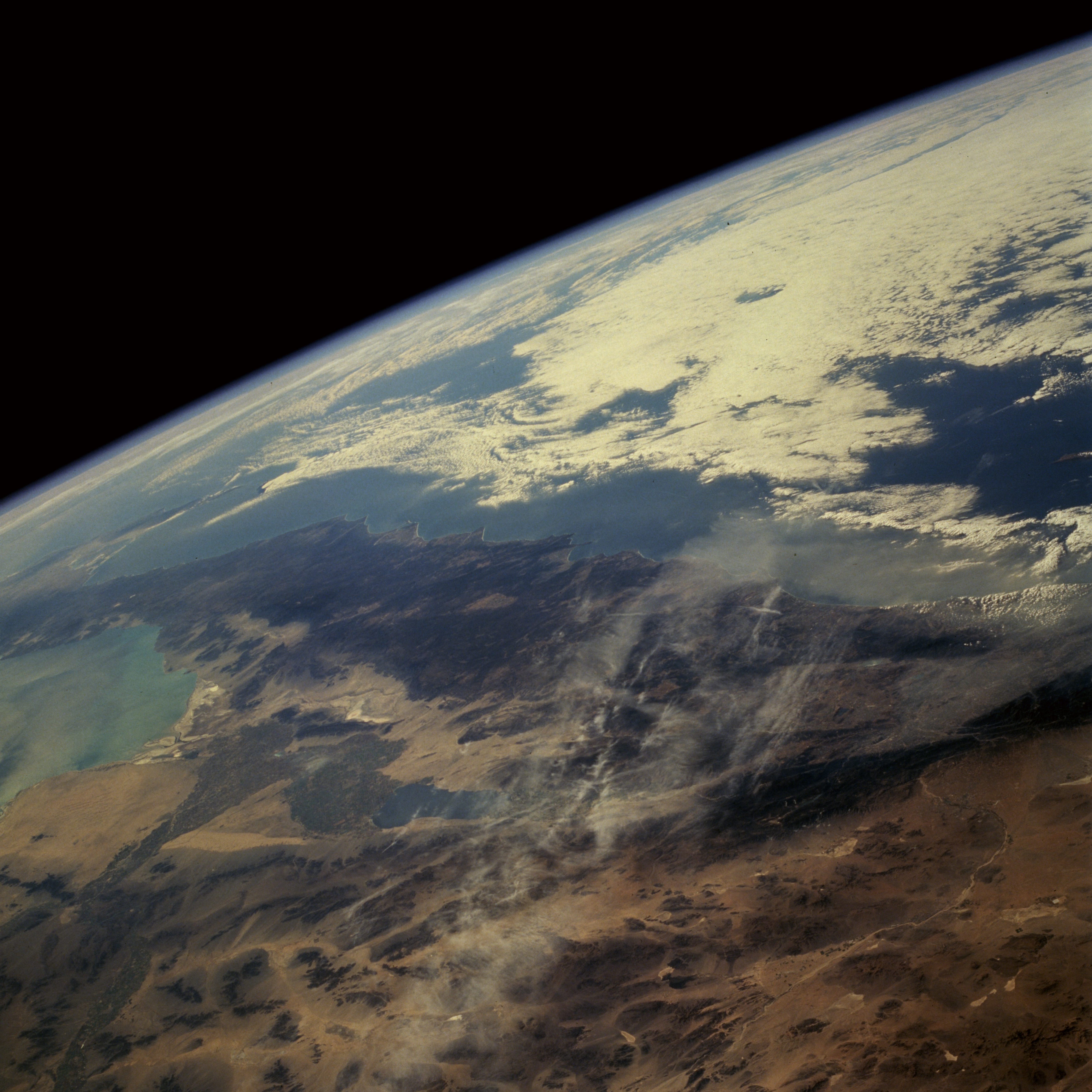
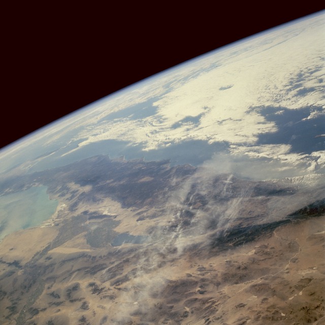
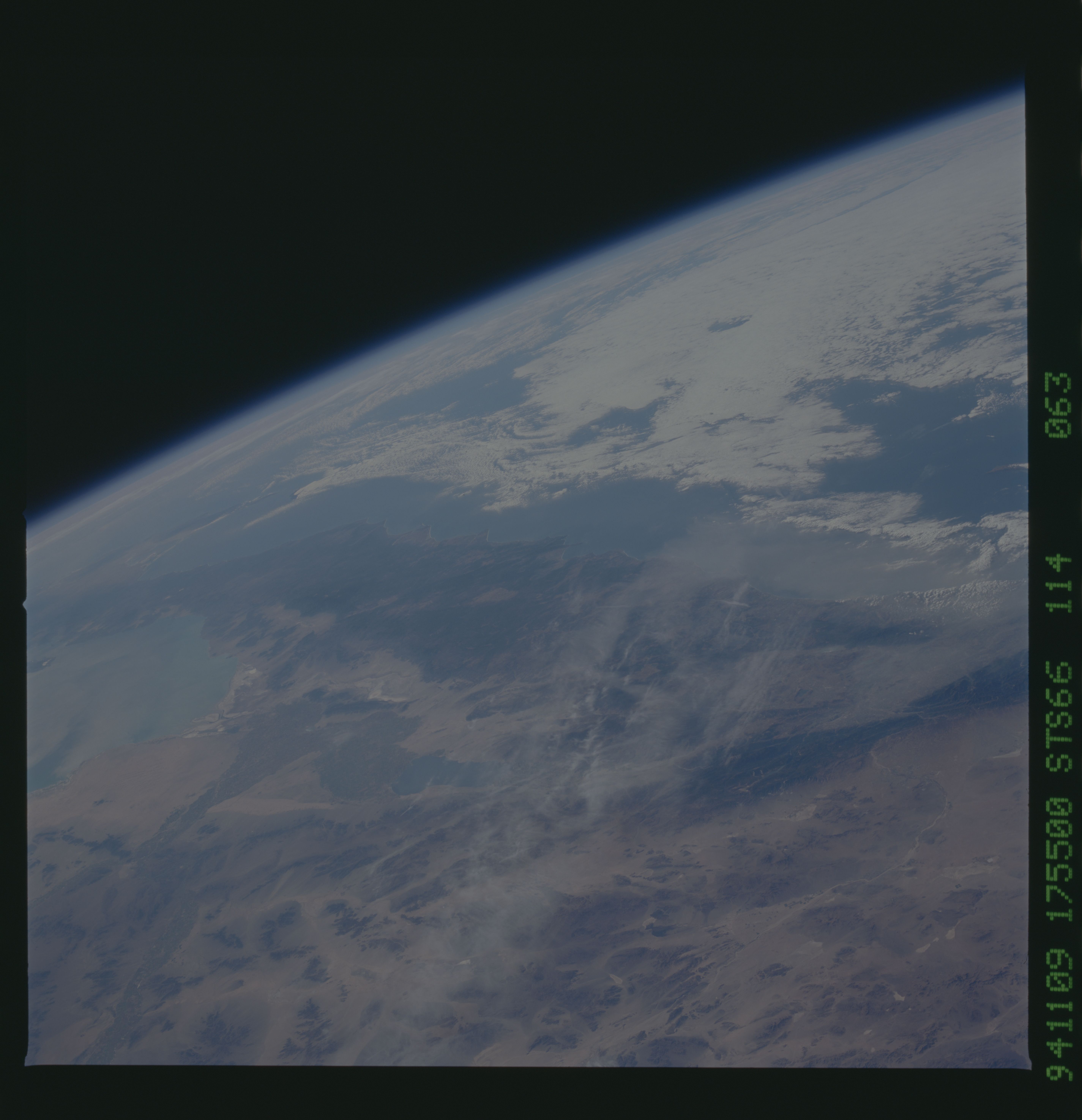
Image Caption: STS066-114-063 Smoke, Haze, Southern California, U.S.A November 1994
Smoke and haze can be seen covering the region from the Los Angeles Basin and San Diego, to north of the Salton Sea (slightly below and left of the center of the image), and across the Mojave Desert in this west-southwest-looking low-oblique view. The Los Angeles Basin, near the right center of the image, is covered with layers of smoke and haze. Winds appear to be blowing the smoke and haze westward across the Mojave Desert and Coastal Mountains into the Pacific Ocean. The Gulf of California and the Baja Peninsula are visible near the left center (south) of the image. Imperial Valley is located south of the Salton Sea.
Smoke and haze can be seen covering the region from the Los Angeles Basin and San Diego, to north of the Salton Sea (slightly below and left of the center of the image), and across the Mojave Desert in this west-southwest-looking low-oblique view. The Los Angeles Basin, near the right center of the image, is covered with layers of smoke and haze. Winds appear to be blowing the smoke and haze westward across the Mojave Desert and Coastal Mountains into the Pacific Ocean. The Gulf of California and the Baja Peninsula are visible near the left center (south) of the image. Imperial Valley is located south of the Salton Sea.
