STS068-257-39
| NASA Photo ID | STS068-257-39 |
| Focal Length | 100mm |
| Date taken | 1994.10.10 |
| Time taken | 17:12:48 GMT |
Resolutions offered for this image:
3904 x 3904 pixels 639 x 639 pixels 5700 x 5900 pixels 500 x 518 pixels 640 x 480 pixels
3904 x 3904 pixels 639 x 639 pixels 5700 x 5900 pixels 500 x 518 pixels 640 x 480 pixels


Cloud masks available for this image:
Spacecraft nadir point: 41.8° N, 103.9° W
Photo center point: 40.5° N, 104.5° W
Photo center point by machine learning:
Photo center point: 40.5° N, 104.5° W
Photo center point by machine learning:
Nadir to Photo Center: South
Spacecraft Altitude: 111 nautical miles (206km)
Country or Geographic Name: | USA-COLORADO |
Features: | DENVER AREA, ROCKY MTS. |
| Features Found Using Machine Learning: | |
Cloud Cover Percentage: | 0 (no clouds present) |
Sun Elevation Angle: | 37° |
Sun Azimuth: | 151° |
Camera: | Hasselblad |
Focal Length: | 100mm |
Camera Tilt: | 38 degrees |
Format: | 5046: Kodak, natural color positive, Lumiere 100/5046, ASA 100, standard base |
Film Exposure: | Normal |
| Additional Information | |
| Width | Height | Annotated | Cropped | Purpose | Links |
|---|---|---|---|---|---|
| 3904 pixels | 3904 pixels | No | No | Earth From Space collection | Download Image |
| 639 pixels | 639 pixels | No | No | Earth From Space collection | Download Image |
| 5700 pixels | 5900 pixels | No | No | Download Image | |
| 500 pixels | 518 pixels | No | No | Download Image | |
| 640 pixels | 480 pixels | No | No | Download Image |
Download Packaged File
Download a Google Earth KML for this Image
View photo footprint information
Download a GeoTIFF for this photo
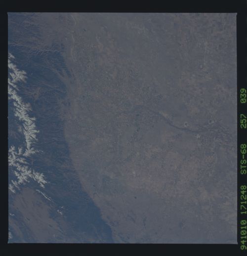
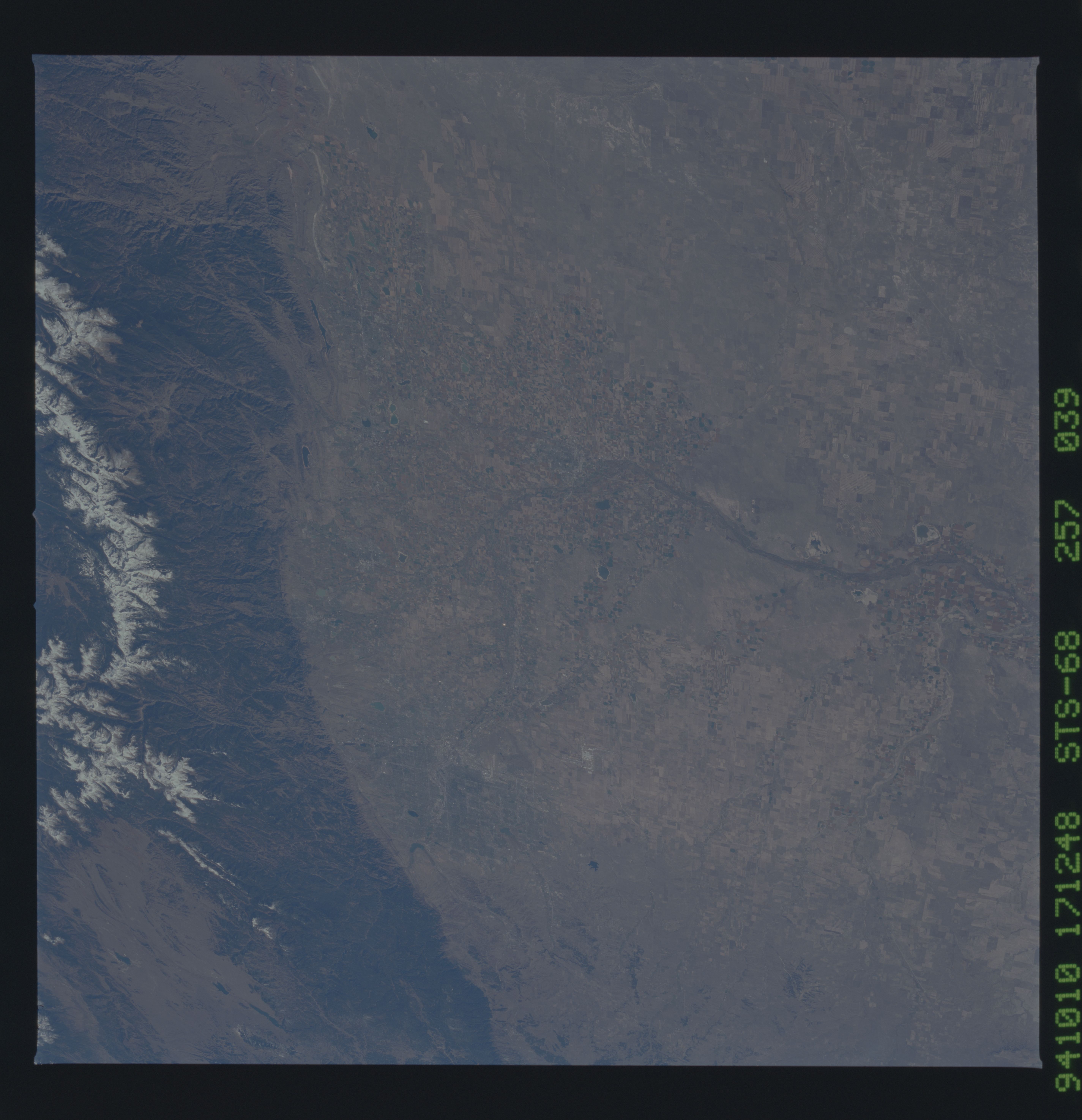
Image Caption: STS068-257-039 Colorado Piedmont Area, Colorado, U.S.A. October 1994
Two distinctive landforms are apparent in this southwest-looking photograph--the Colorado Piedmont and the snow-covered higher elevations of the Front Range of the Rocky Mountains. The relatively flat Piedmont extends from just south of greater Denver (middle left edge of the photograph) to north of Fort Collins, sloping gradually west to east. The South Platte River and some of its tributaries flow north through the Denver area and turn east-northeast across northeastern Colorado, displaying a fairly broad floodplain (near bottom center). Numerous cultivated field patterns show widespread dry land farming throughout the region.
Two distinctive landforms are apparent in this southwest-looking photograph--the Colorado Piedmont and the snow-covered higher elevations of the Front Range of the Rocky Mountains. The relatively flat Piedmont extends from just south of greater Denver (middle left edge of the photograph) to north of Fort Collins, sloping gradually west to east. The South Platte River and some of its tributaries flow north through the Denver area and turn east-northeast across northeastern Colorado, displaying a fairly broad floodplain (near bottom center). Numerous cultivated field patterns show widespread dry land farming throughout the region.
