ISS048-E-38518

| NASA Photo ID | ISS048-E-38518 |
| Focal Length | 420mm |
| Date taken | 2016.07.19 |
| Time taken | 13:30:14 GMT |
4928 x 3280 pixels 720 x 480 pixels 4928 x 3280 pixels 640 x 426 pixels


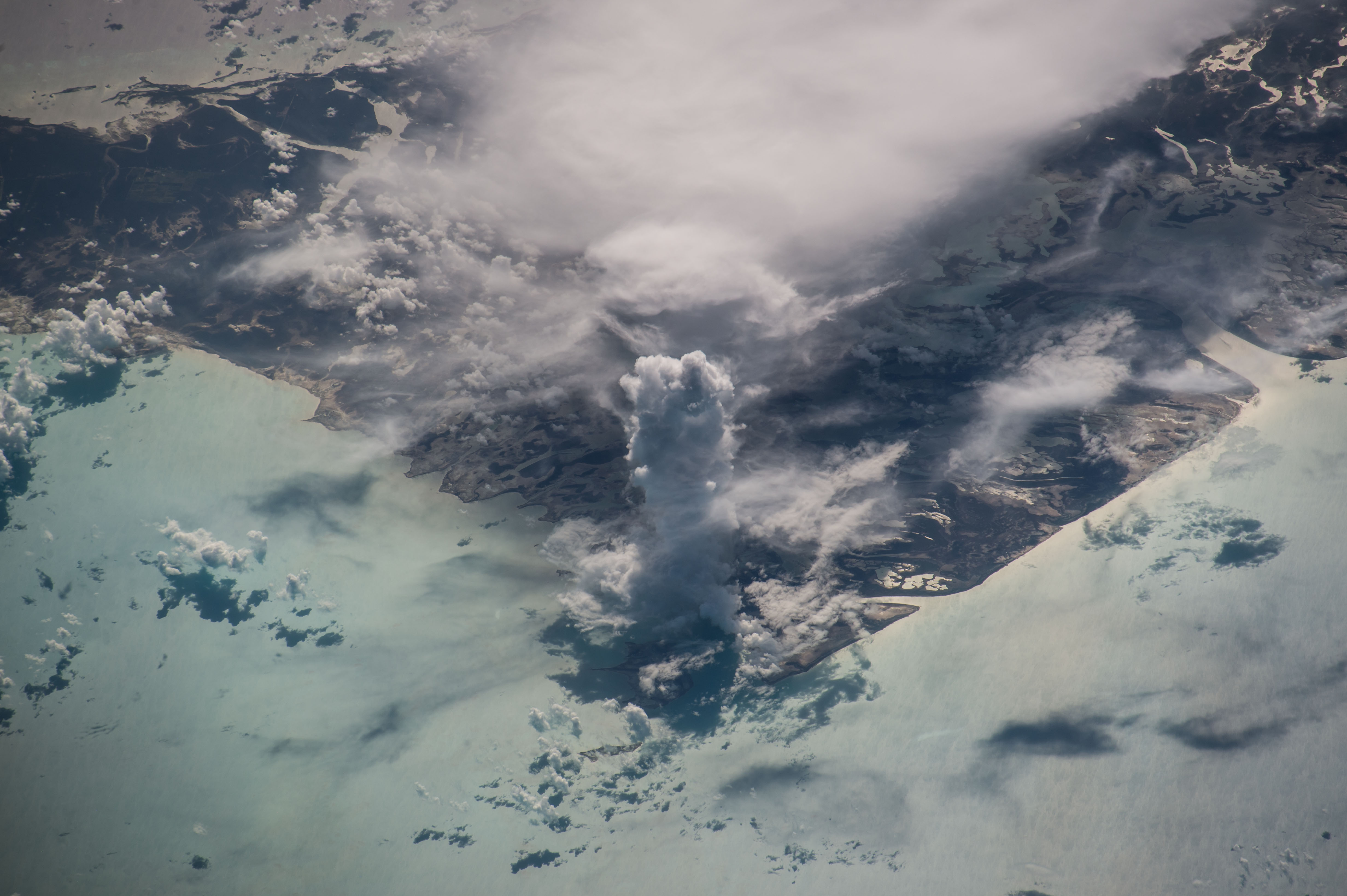


Photo center point: 24.7° N, 78.3° W
Photo center point by machine learning:
Country or Geographic Name: | BAHAMAS |
Features: | BILLY ISLAND, WILLIAMS ISLAND, ANDROS ISLAND |
| Features Found Using Machine Learning: | |
Cloud Cover Percentage: | 75 (51-75)% |
Sun Elevation Angle: | 32° |
Sun Azimuth: | 79° |
Camera: | Nikon D4 Electronic Still Camera |
Focal Length: | 420mm |
Camera Tilt: | High Oblique |
Format: | 4928E: 4928 x 3280 pixel CMOS sensor, 36.0mm x 23.9mm, total pixels: 16.6 million, Nikon FX format |
Film Exposure: | |
| Additional Information | |
| Width | Height | Annotated | Cropped | Purpose | Links |
|---|---|---|---|---|---|
| 4928 pixels | 3280 pixels | No | No | NASA's Earth Observatory web site | Download Image |
| 720 pixels | 480 pixels | Yes | No | NASA's Earth Observatory web site | Download Image |
| 4928 pixels | 3280 pixels | No | No | Download Image | |
| 640 pixels | 426 pixels | No | No | Download Image |
An astronaut aboard the International Space Station took this photograph of a massive vertical cloud formation--known to meteorologists as cumulus castellanusA--above Andros Island.
These towering columnar clouds are part of the genus cumulonimbus. The cloud name castellanus comes from the similarity to the crenellated towers or turrets of medieval castles. The International Cloud Atlas (World Meteorological Organization) classifies clouds of this type as either Altocumulus castellanus or Stratocumulus castellanus, depending on the base cloud height from which they develop. Regardless of the nomenclature, these clouds develop due to strong vertical air movement typically associated with thunderstorms.
Part of the Bahamas archipelago, Andros Island is divided by large estuaries into three sections. North Andros, Central Andros, and South Andros are each comprised of several smaller islets and cays that are connected by smaller estuaries. Together, Andros Island is the largest in total area (2,300 square miles or 6,000 square kilometers) of all 700 islands in the Bahamas.
