STS059-L09-150

| NASA Photo ID | STS059-L09-150 |
| Focal Length | 250mm |
| Date taken | 1994.04.10 |
| Time taken | 21:36:25 GMT |
Cloud masks available for this image:
Spacecraft nadir point: 42.6° N, 122.4° W
Photo center point: 41.5° N, 123.5° W
Photo center point by machine learning:
Photo center point: 41.5° N, 123.5° W
Photo center point by machine learning:
Nadir to Photo Center: Southwest
Spacecraft Altitude: 119 nautical miles (220km)
Country or Geographic Name: | USA-CALIFORNIA |
Features: | KLAMATH MOUNTAINS & RIV. |
| Features Found Using Machine Learning: | |
Cloud Cover Percentage: | 5 (1-10)% |
Sun Elevation Angle: | 51° |
Sun Azimuth: | 215° |
Camera: | Linhof |
Focal Length: | 250mm |
Camera Tilt: | 38 degrees |
Format: | 5048: Kodak, natural color positive, Lumiere 100x/5048, ASA 100x, standard base |
Film Exposure: | Under Exposed |
| Additional Information | |
| Width | Height | Annotated | Cropped | Purpose | Links |
|---|---|---|---|---|---|
| 5088 pixels | 4000 pixels | No | No | Earth From Space collection | Download Image |
| 640 pixels | 503 pixels | No | No | Earth From Space collection | Download Image |
| 640 pixels | 480 pixels | No | No | ISD 1 | Download Image |
Download Packaged File
Download a Google Earth KML for this Image
View photo footprint information
Download a GeoTIFF for this photo
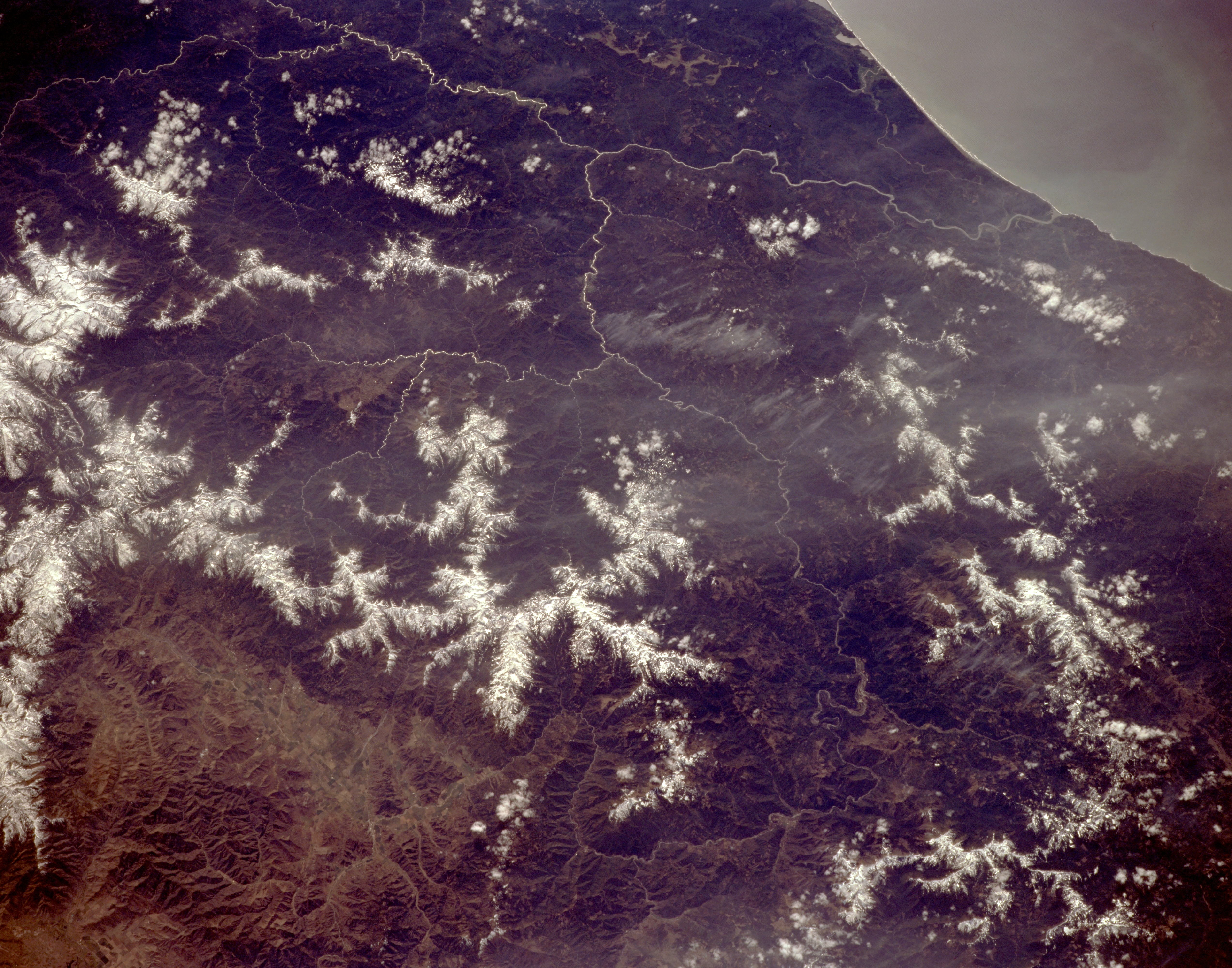
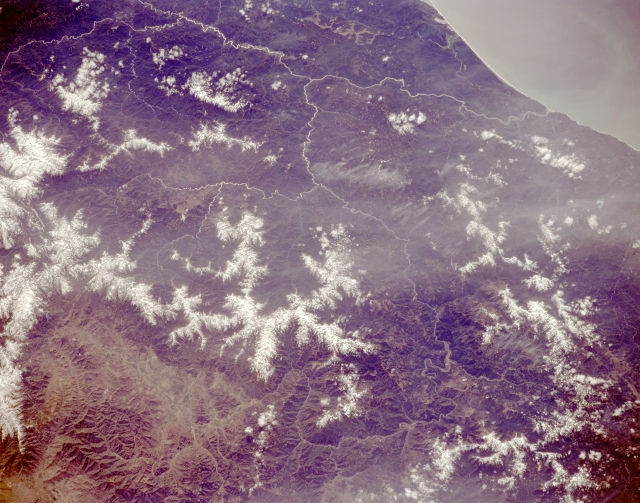
Image Caption: STS059-L09-150 Klamath Mountains and Klamath River, California, U.S.A. April 1994
The rugged, snow-covered Klamath Mountains, part of the Coast Range, are featured in this southwest-looking, low-oblique photograph. The Klamath Mountains have numerous peaks exceeding 7000 feet (2135 meters). The Klamath River is visible winding south and then northwest, following the Hoopa Valley Indian Reservation, and emptying into the Pacific Ocean (top right of photograph) south of Crescent City, California.
The rugged, snow-covered Klamath Mountains, part of the Coast Range, are featured in this southwest-looking, low-oblique photograph. The Klamath Mountains have numerous peaks exceeding 7000 feet (2135 meters). The Klamath River is visible winding south and then northwest, following the Hoopa Valley Indian Reservation, and emptying into the Pacific Ocean (top right of photograph) south of Crescent City, California.
