Geographic Region: CHINA
Feature: HIMALAYA MTS., MT. EVEREST
|
Geographic Region: CHINA Feature: HIMALAYA MTS., MT. EVEREST |
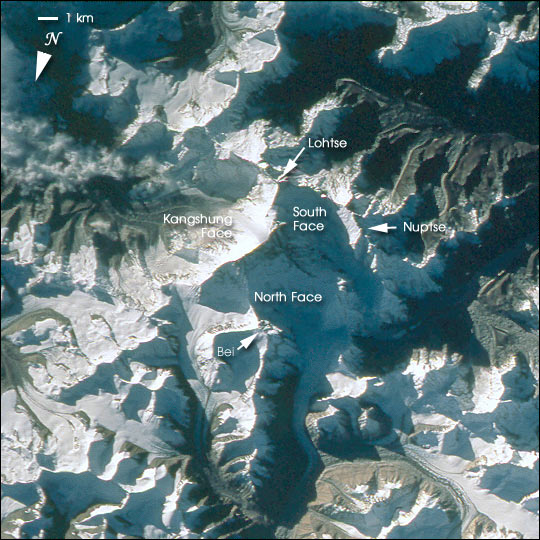 |
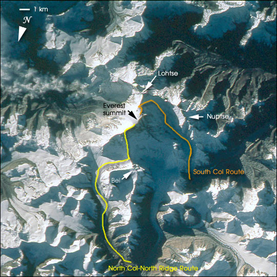
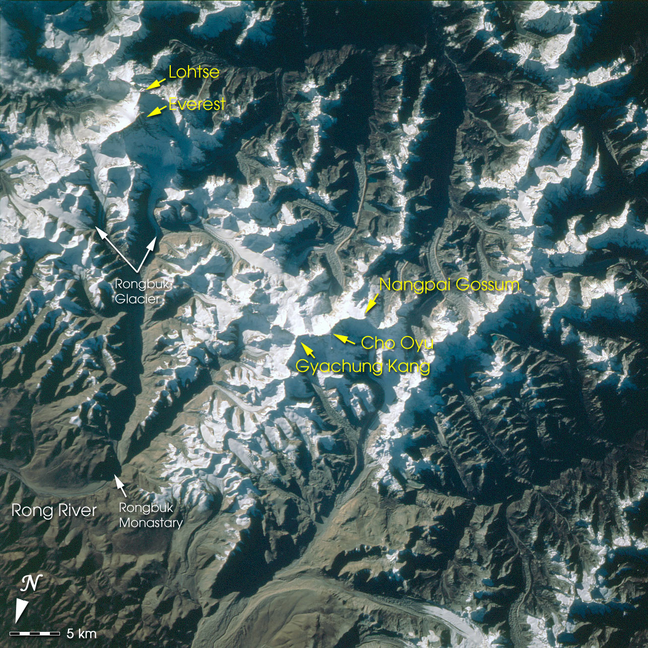
| Mt. Everest is the highest (29,035 feet, 8850 meters) mountain in the world. This detailed look at Mt. Everest and Lohtse is part of a more extensive photograph of the central Himalaya taken in October 1993 that is one of the best views of the mountain captured by astronauts to date. It shows the North and South Faces of Everest in shadow with the Kangshung Face in morning light. Other major peaks in the immediate area are Nuptse and Bei Peak (Changtse). The picture was taken looking slightly obliquely when the spacecraft was north of Everest. Everest holds a powerful fascination for climbers and trekkers from around the world. The paths for typical North and South climbing routes are sketched on this image. Much of the regional context can be seen in the complete photograph, which shows Mt. Everest and other large peaks to the northwest. More information on the photograph STS058-101-12 can be found at the Gateway to Astronaut Photography of Earth. An unannotated version can also be downloaded. The digital images shown have been reduced to a spatial resolution equivalent to 48 m / pixel; a high-resolution digital image of the same photograph would be at 12 meters per pixel. |
| Images: | All Available Images Low-Resolution 90k |
|
| Mission: | STS058 |
|
| Roll - Frame: | 101 - 12 |
|
| Geographical Name: | CHINA |
|
| Features: | HIMALAYA MTS., MT. EVEREST |
|
| Center Lat x Lon: | 28.0N x 86.5E |
|
| Film Exposure: | N | N=Normal exposure, U=Under exposed, O=Over exposed, F=out of Focus |
| Percentage of Cloud Cover-CLDP: | 0 |
|
| Camera:: | HB |
|
| Camera Tilt: | 13 | LO=Low Oblique, HO=High Oblique, NV=Near Vertical |
| Camera Focal Length: | 250 |
|
| Nadir to Photo Center Direction: | SE | The direction from the nadir to the center point, N=North, S=South, E=East, W=West |
| Stereo?: | Y | Y=Yes there is an adjacent picture of the same area, N=No there isn't |
| Orbit Number: | 72 |
|
| Date: | 19931023 | YYYYMMDD |
| Time: | 013345 | GMT HHMMSS |
| Nadir Lat: | 28.4N |
Latitude of suborbital point of spacecraft |
| Nadir Lon: | 86.1E |
Longitude of suborbital point of spacecraft |
| Sun Azimuth: | 112 | Clockwise angle in degrees from north to the sun measured at the nadir point |
| Space Craft Altitude: | 150 | nautical miles |
| Sun Elevation: | 14 | Angle in degrees between the horizon and the sun, measured at the nadir point |
| Land Views: | MOUNTAIN |
|
| Water Views: | |
|
| Atmosphere Views: | |
|
| Man Made Views: | |
|
| City Views: | |
|
Photo is not associated with any sequences | ||
| NASA Home Page |
JSC Home Page |
JSC Digital Image Collection |
Earth Science & Remote Sensing |
|
This service is provided by the International Space Station program and the JSC Earth Science & Remote Sensing Unit, ARES Division, Exploration Integration Science Directorate.

|